Rudston and the Ritual Landscape of the Great Wolds Valley

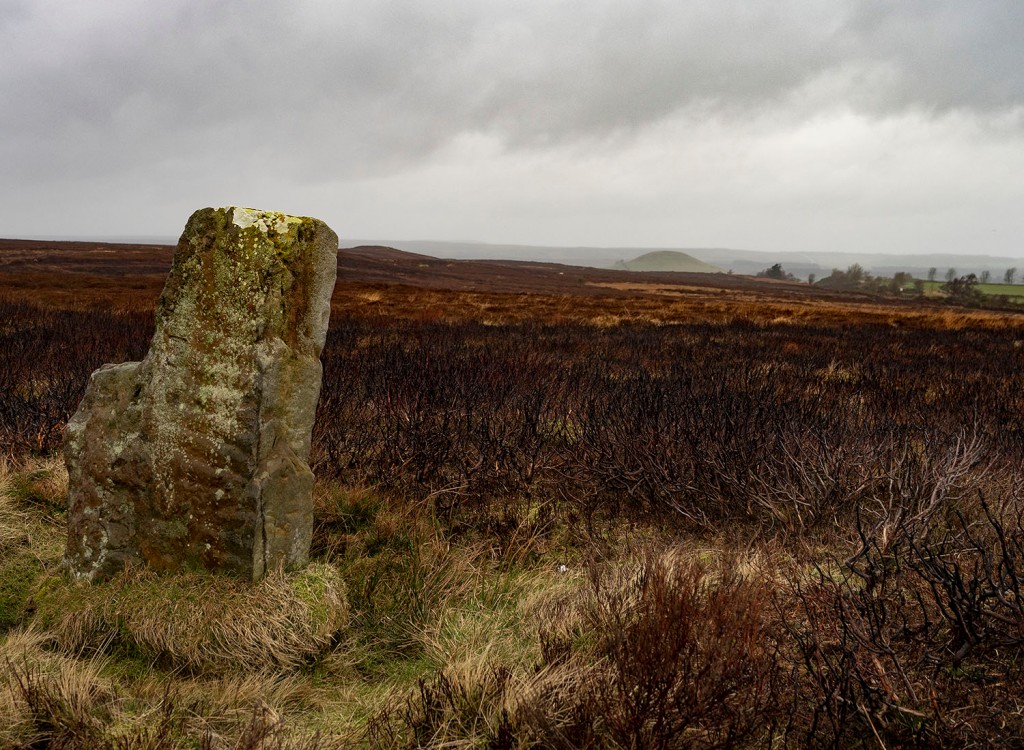
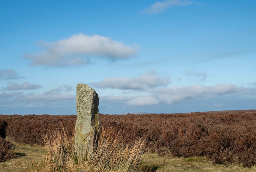
Continuing my tour of the Wolds, I couldn’t drive past Britain’s tallest standing stone and not stop and say hello. I spent a little time just sitting in the sun watching the to and fro of visitors coming to admire the mighty stone.

In East Yorkshire, owing to the absence of suitable stone, megaliths are rare. Yet it contains the tallest monolith in the county if not England. It stands even yet on a sacred site, in Rudston church yard, five miles west of Bridlington. it is 25 1/2 feet high, 3 1/2 feet higher than the tallest sarsen at Stonehenge., and is 6 feet wide and 2 1/2 feet thick at the base. It has been shaped out of a block of grit, the nearest outcrop of which occurs in the cliffs and scars of Cayton and Carnelian Bays over ten miles away. It doesn’t appear to have been noticed that on the north-east side of the churchyard there is an upright stone of grit, rudely triangular in shape, and 3 to 4 feet high. Near it is a cist of sandstone slabs, probably unearthed by some sexton.

Frank & Harriet Wragg Elgee. 1932

What Frank & Harriet Wragg Elgee didn’t realise was that the Rudston monolith is just one element in a ritual landscape with a monument complex that is unequalled in Britain.

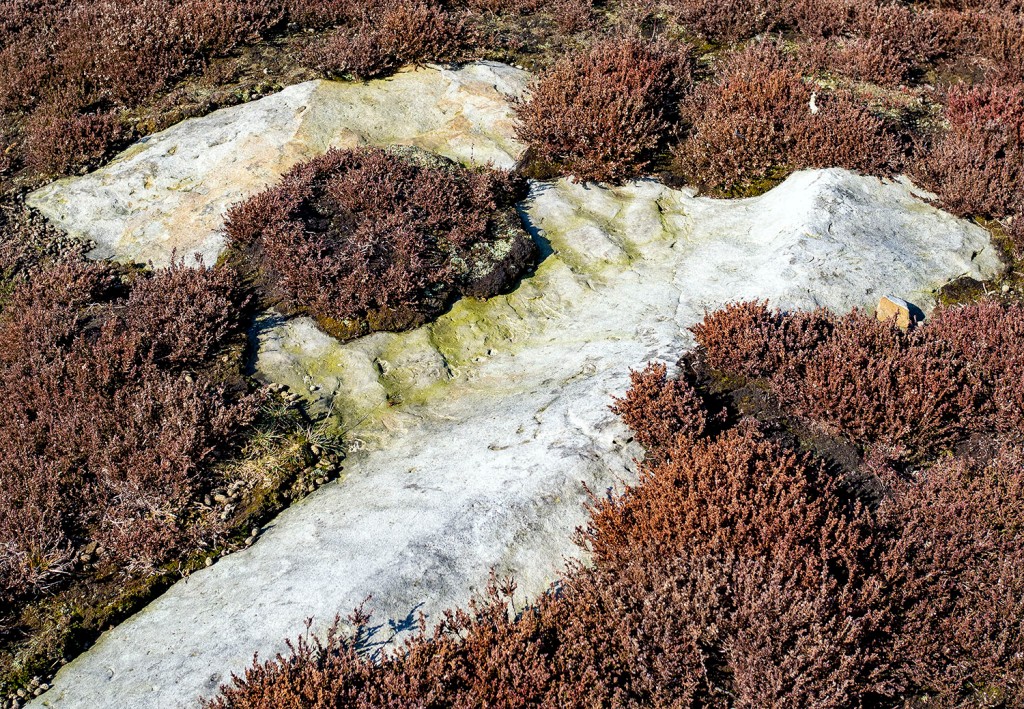
The Yorkshire Wolds are elevated upland plateau with an underlying geology of chalk and limestone. There is very little running water on the Wolds because the groundwater seeps through the chalk bedrock to form a network of underground streams and reservoirs. The Great Wold Valley, in the north of the Wolds, is the only valley close enough to the water table to sustain any amount of free-flowing surface water.

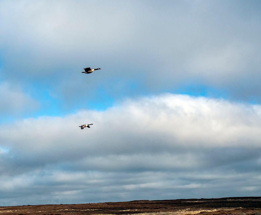
The stream that flows along the floor of the valley is called The Gypsey Race, the most northerly chalk river in Britain. The Gypsey Race is known as a winterbourne stream as it only flows when the water table is high enough to reach the valley floor. In summer the stream may only flows in small sections, if at all, before disappearing underground.

The stream rises at a series of springs close the Great Barrow of Duggleby Howe, it then flows eastwards along the Great Wolds Valley until it reaches the sea at Bridlington, a distance of about 20 miles.

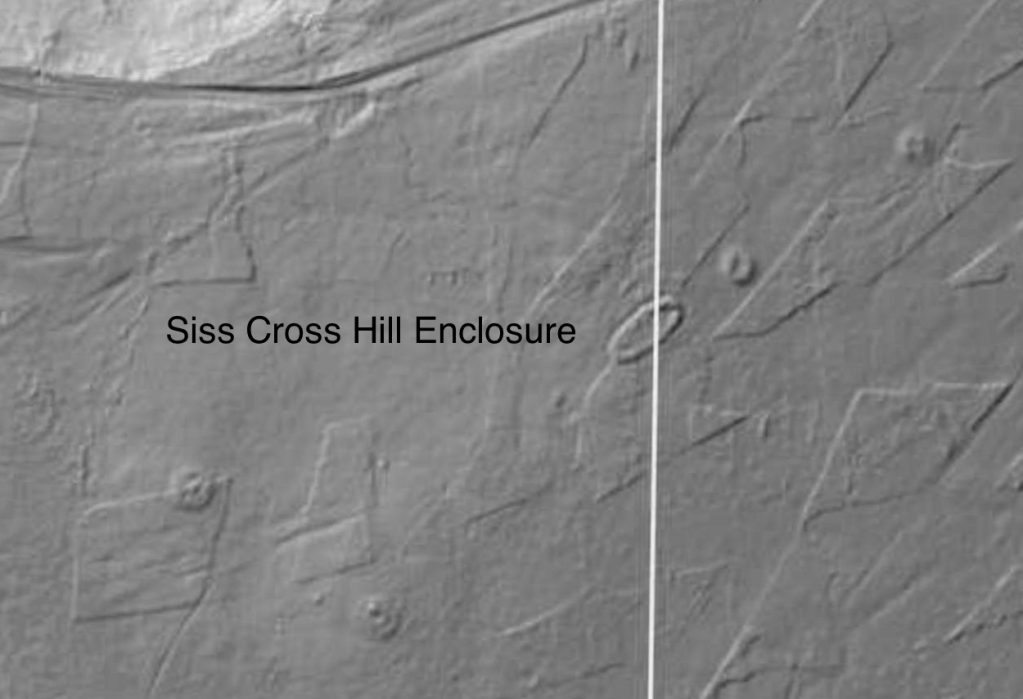
The short course of the Gyspey Race is marked by a large number of prehistoric monuments, most of which date to the Neolithic. These monuments include a number of great barrows, cursuses (The greatest concentration in Britain), at least 1 henge, long barrows and various enclosures. This density of prehistoric monuments dating to around 3000-3500 BC makes it one of the most important Neolithic landscapes in our islands.

Little Argham Henge

The Rudston monolith is located on a spur in the angle of the Great Wolds Valley, the spur is the focus for 3 cursus monuments with 4th running along the valley. This indicates that Rudstone was probably an extremely important site 5000 years ago.

The area continued to be occupied throughout the Bronze and Iron ages. There are the remains of a large Roman villa close to the village, which, when excavated, revealed a couple of beautiful mosaic floors which can now be seen in the museum in Hull.

The church beside the Rudston monolith was founded in 1100AD, 4000 years after the monuments of the Great Wold Valley were constructed. It could be argued that Rudston is one of the oldest, continually-occupied sites in Britain. The builders of the church obviously still considered this site to be a ‘special’ place and chose to build their church next to the monolith rather than destroy it.

I’ve visited the Rudston monolith a number of times but had never previously set foot inside of the church, I took a look. One point of interest was the Norman font, that pattern is very similar to the font I’d seen at Weaverthorpe. The church is nice enough but to be honest, it cannot compete with its rude-stone neighbour and the ancient ritual landscape buried beneath the fields of the Great Wolds Valley.

I was recently having a conversation with a friend and mentioned my visit to Rudston. I told her about the Great Wolds Valley, she was quite surprised that she wasn’t aware of this huge ritual landscape. Perhaps these sites would be better known and understood if they were located in the south of our island rather than in a ‘remote’ corner of East Yorkshire.

Folklore

The Gypsey Race

Occasionally the Gypsey Race floods, this has happened roughly every 50-60 years causing devastation in the villages and farms along the Great Wolds Valley. The last flood event was Christmas 2012 and caused a number of homes to be flooded. As far back as the Middle Ages, the flooding of the Gypsey Race was said to foretell a national disaster. The stream is said to have flooded prior to the Great Plague of 1665, it is also said to have flooded prior to both World Wars. Thankfully 2013 was fairly uneventful in terms of national disasters.

The Rudston Monolith

The huge stone shares a legend with many other great stones that the stone was thrown at the church by the devil, as usual, the devil missed his target.

Sources

The Archaeology of Yorkshire by Frank & Harriet Wragg Elgee. 1933

The Archaeology of Yorkshire – An assessment at the beginning of the 21st Century. Edited by T.G. Manby, Stephen Moorhouse and Patrick Ottaway. Yorkshire Archaeological Society Occasional Paper No.3. 2003

A Gypsey’s Warning by Mike Haigh. Northern Earth. Issue 133. 2013

Lidar Image – https://www.lidarfinder.com/

Aerial Image – https://earth.google.co.uk/

The Swang – Barely a square centimeter of stone is visible

A lichen is not a single organism; it is a stable symbiotic association between a fungus and algae and/or cyanobacteria.

Like all fungi, lichen fungi require carbon as a food source; this is provided by their symbiotic algae and/or cyanobacteria, that are photosynthetic.

The lichen symbiosis is thought to be a mutualism, since both the fungi and the photosynthetic partners, called photobionts, benefit.

The British Lichen Society

Escaping the mad parade

Walking from Farndale up towards Rudland Rigg, we followed the track up the side of Monket Bank. The track climbs up through the old jet workings and quarries along the moor edge.

In the 14th century this route was known as Monckgate and linked Bransdale with Farndale. The track was used as a Church or Corpse Road with coffins being carried over the rigg to Cockan Kirk in Bransdale.

The road across the rigg is now known as Westside Road, in the past, it was known as Waingate, running from Kirkbymoorside Market Place in the south to Battersby Bank in the north.

We cut out across the moor towards Ousegill Head and the Three Howes. Flint tools had been found by the gamekeepers for a number of years so in September 1973 Raymond Hayes and others excavated the area. His small excavation yielded over 800 flints from an area of 3.50 x 3.0m. The site was interpreted as ‘A temporary camping site in a forest clearing, probably being occupied by hunters following red deer or other game.’

Whilst at the Three Howes we saw a Red Kite being harassed by an anxious Curlew. Once the Kite had rid itself of its tormentor it flew directly over us, a joyful moment, this was my first sighting of a Kite on the moors.

We walked back across the old peat workings and rejoined the track, moving on to the waymarker at Cockam Cross and then onto our final goal, the Cammon Stone.

The Cammon Stone is a prehistoric standing stone that sits just beside the main track. The stone is about a metre and a half tall and leans towards the west. I have been visiting this stone on and off for at least two decades, my perception is that the lean of the stone has increased over the years but I may be wrong, I hope I am. The southern views from the stone look down along Bransdale, the axis of the stone is also aligned in this direction, which is probably no coincidence.

There are a number of faded letters carved onto the western face of the stone, in the past, antiquarians had speculated as to whether these letters were Phoenician in origin. They are actually Hebrew and spell out the word halleluiah. They are thought to be the work of the Reverend W Strickland, Vicar of Ingleby. Strickland is thought to be responsible for carving a number of inscriptions in this area.

There is a second stone, a large flat slab. No one knows whether this slab ever stood upright. There is no obvious weathering patterns to indicate that it might have been upstanding but I guess that question could only ever be answered by an archaeological investigation.

We picked our way along a track that ran from the moortop into Farndale and joined the daleside road at Spout House. If you are a fan of stone walls and troughs, you will love this road, it has massive walls with stone-lined gutters and numerous multiple carved stone troughs. The stonemasons and wallers were once kept busy in this area.

Also on this road is the Duffin Stone, a massive boulder that has tumbled down from the escarpment side and is embedded into the verge of the narrow lane. The stone bears the scars of contact with many vehicles.

Etymology

Waingate – OE Waen Way – Waggon Road

Monket – The ‘Mun(e)k(e)’ spellings suggest ‘monks’, but in the absence of monastic associations one might suspect an earlier ‘Mened-cet’ (Welsh Mynydd-coed) – ‘forest hill’. Here one might compare ‘Monket House’ in north-east Yorkshire.

Cammon Stone – Cam Maen – Bank Stone.

Rudland – OE hrycg ON hyrggr ‘ridge’.

Sources

Old Roads & Pannierways in North East Yorkshire. R. H. Hayes.1988. The North York Moors National Park.

Yorkshire Archaeological Journal. Vol.67. 1995. The Yorkshire Archaeological Society.

The Consise Oxford Dictionary of English Place-Names. Eilert Ekwall. 1974. Oxford.

The Old Stones of the North Exhibition

Circumstances have prevented me from visiting our joint exhibition, so this week we took a trip over to Grasmere to have a look. I was impressed with the way that the Heaton Cooper Studio has presented our work. The exhibition runs until the 29th May.

The Smell of Water Part 3: Danby Rigg

Tank Road II

A recent online conversation with a friend re-sparked my curiosity about the Tank Road. It’s an area that I’ve visited many times over the years, I’ve always felt that it was an important place but I’ve never fully got to grips with it. So I decided to walk it and try to pull together a description of the area.

I’ve always known it as the Tank Road or Old Tank Road, presumably it got this name from when it was used as a Tank training ground during WWII. The road itself is only 3.5km long, it runs between the main north-south roads to Castleton and Danby. From east to west, the road starts on the main north-south road to Danby and then crosses Gerrick Moor, Tomgate Moor and Middle heads where it meets the Castleton Road at White Cross on Three Howes Ridge.

On walking the road it becomes apparent that it was a busy route in the past, there is evidence of a number of sunken trackways, following the line of the road and joining the road from other routes, this becomes more obvious when you look at the LIDAR images of the area.

Regarding the origins of the road itself. There have been two excellent books written on the trackways of the North York Moors, Old Roads and Pannierways in North East Yorkshire by Raymond H. Hayes and Trods of the North York Moors by Christopher P. Evans. Hayes regards the route as possibly part of the Pannierman’s Causeway from Castleton to Staithes. Evans thinks it is part of a trod from Liverton Moor to Commondale. I suspect this route may have its origins in Prehistory.

Walking from east to west.

The road starts at the bend of the road that runs from the A171 to Danby where there is a small parking area. I definitely would not recommend trying to drive along the road. The road crosses a number water courses, the boggy areas have been filled with building rubble, it’s not unusual to find parts of cars on the side of the road.

The most prominent monument at the start of the road is a large Barrow, one of a group known as Robin Hood’s Butts. Danby Beacon can be seen in the distance in the image above .

The next group of monuments lie just south of the road comprising of a barrow and an embanked circular feature known as an Enclosed Urnfield. The enclosure and barrow date to the Bronze Age. The enclosure was a place where the cremated remains of the dead were placed, often in small pottery vessels. This type of monument is quite rare, they are generally only found in Northern England and Southern Scotland. Only 50 examples are known, 3 of which are within a few minutes walk of the Tank Road.

Photographing many of these prehistoric monuments is quite difficult, most of them are fairly low-lying features, covered in heather on a heather moor. The vegetation is quite low at the moment so this is probably the best time of the year to visit and once you get you eye in they are not to difficult to spot. I’ve included a few Open Access LIDAR images as they give a better idea of the form of the monuments.

To the north of the road is a large standing stone. The stone is unusual as it is ‘L’ shaped and its surface has fossil ripple marks on its surface. There are no obvious outcrops of stone on this part of the moor, but there is an outcrop with similar ripple marks on the western flanks of Siss Cross Hill just under 2km away. Perhaps this was the source of the stone.

In the top image, behind the standing stone, you can see the large burial mound of Herd Howe in the middle distance and beyond that Freebrough Hill. Just below Herd Howe is an enclosure that dates to the Iron Age. I have previously written an account of the enclosure, Herd Howe and the nearby Cross Dyke.

On my last two walks along the road I have seen quite a number of geese. I presume they are overwintering here. On my last visit this pair flew towards me honking, circled me and then headed back to Dimmingdale.

Leaving the road I followed a track south to have a look at Siss Cross. The cross is a crude unworked upright stone, it may be a replacement for the original cross. Running down the hill from the cross are a number of sunken trackways, perhaps the cross was a route-marker. Back in the 19th Century local Antiquarian J.C Atkinson discovered what he described as a flint tool making site just south of Siss Cross. He collected enough flint tools and debitage to fill ‘half a fair sized fishing basket’. The flint tools are thought to have been made by Mesolithic hunter gatherers. The site would have been a good place for a hunting camp, it is well drained and has a large viewshed, even on a muggy day I was able to look along the Esk Valley and make out the distinctive profile of the RAF site on Fylingdales Moor over 21km away.

I headed back to the Tank Road via the Trig point on the top of Siss Cross Hill. There is another Enclosed Urnfield with associated Barrows here. Unlike the previous enclosure this one is oval in shape and quite large 38x20m. Interestingly, the enclosure and the two associated barrows are aligned on the western-most Barrow of the Robin Hood’s Butts group. This alignment is also roughly the direction of the Midsummer sunrise and Midwinter sunset. The enclosure is also intervisible with the third Enclosed Urnfield on Moorsholm Rigg.

I walked back onto the road from Siss Hill and followed it down into Ewe Crag Slack. The slack is a former glacial drainage channel and is generally quite boggy. The keepers and the farmer struggle to keep the road passable down here, the place is a jumble of boulders, concrete posts and deep muddy ruts.

Ewe Crag Slack is a significant location in the study of prehistory on the moors as it was one of a number of places where Paleoenvironmental pollen cores were taken from the peat and the sediments below it. The data from Ewe Crag helped provide evidence that the people who lived here during the Mesolithic period may have been actively managing the land. The pollen cores showed evidence of forest destruction and subsequent soil erosion, this combined with charcoal deposits suggests that people may have been creating forest clearings much earlier that was previously thought.

I noticed this boulder by the side of the road. The boulder has been broken but you can see that it’s original form was rounded. The rock type looks like a fine grained igneous rock, basalt or andesite. I presume it is a glacial erratic. It’s curious because less than a kilometre away, at Dimmingdale, is a barrow that was excavated in the 19th Century by J.C. Atkinson, the same antiquarian who found the Siss Cross Flints. Atkinson wrote that the barrow contained ‘blocks of basalt from the Cleveland Dyke’. It is possible that the stones came from the Cleveland Dyke, the nearest potential outcrop that I’m aware of is at Scale Cross 4.2km away, where it was quarried in the modern era. I wonder if the barrow stones may have originated closer to home as glacial erratics washed-down to Dimmingdale when the ice began to melt. One for further research.

Walking the final section of the road to White Cross my camera battery died. The final 2 images were taken when wandering the road in 2017, they are a Danby-Moorsholm guidestone & White Cross.

Resources

Lidar Maps – Open Data Maps

Old Roads and Pannierways in North East Yorkshire by Raymond H. Hayes. 1988

Trods of the North York Moors by Christopher P. Evans. 2008

Early Man in North-East Yorkshire by Frank Elgee. 1930

Excavated Bronze Age Burial Mounds of North East Yorkshire by M.J.B Smith. 1994

Along The Esk. A Guide to the Mining Geology of the Esk Valley by Denis Goldring. 2006

A contribution to the late quaternary ecological history of Cleveland, North-East Yorkshire by R.L. Jones

Historic England