River Esk
Found


Sleights Moor


A friend and I took a walk around Sleights moor starting at the High Bride Stones, a group of Prehistoric Standing Stones that have been interpreted as the possible ruins of two Four-Poster Stone Circles or the remains of a number of Stone Rows.

We followed the lines of stones to the edge of the moor and the descent into the Murk Esk valley.
 A Ladder trap, one of two in this small area, both thankfully empty.
 Descending the bank to the Low Bride Stones on Sheephowe Rigg.


Like the High Bride Stones on the moor above, this is a very ruinous site. Archaeological surveys have revealed over 100 stones including a mutilated cairn. The current best guess is that many of the stones once formed part of a prehistoric enclosure.


We moved north along the top of Lowther Crag to the disused Bolton Crag quarry, one source of the beautiful Middle Jurassic moorland sandstone. Across the Esk valley we can see the quarries at Aislaby. Stone from these quarries was used to build the 11th century Abbey at Whitby, the foundations of the old Waterloo and London Bridges and the piers at Whitby.
 Walking up onto the moor top we found small, loose boulders made of ‘white flint’. This stone was prized by the steel industry, its high silica content, up to 98%, meant that it was ideal for making refractory bricks and moulding sand.

We moved across the highest part of the moor to Black Brow and its two Bronze Age kerbed burial mounds, the Flat Howes. This is the highest section of the moor, there are uninterrupted views along the Esk Valley to the Kildale Gap, across the moors towards Fylingdales and down to the coast into Whitby, a fitting place to spend eternity.
Crown End
This morning I headed over to Westerdale Moor. I’ve been visiting this moor for many years and have always had the place to myself. As I walked up to the moor from Hob Hole I noticed a group of estate workers over on Little Hograh Moor, I made a small bet with myself that I’d be getting a visit from a gamekeeper within half an hour of setting foot on the moor.
The heather is in full bloom and the moors look stunning, after a few short minutes my boots were covered in a fine dusting of heather pollen. Later I encountered thousands of tiny bees congregating on a sandy bank at the side of the path, I presume these were Miner bees making the most of the pollen harvest.
My first landmark on the moor was the standing stone which can be seen from the footpath on the west end of the moor, this stone is below the crest of the ridge and is about 1.2m tall


Due north of the stone and about 100m over the ridge of the moor is an alignment of standing stones and boulders that runs for about 70m towards the Baysdale Beck, also known as the Hob Hole Beck. This alignment has been interpreted as a Bronze Age boundary and features in Blaise Vyner’s inventory of Cross Ridge Boundaries.


Returning to the path I noticed an object embedded in the dry mud at the side of the track. It was a Swiss Army knife, it had obviously been there for a while and had a name dymo-taped onto it, Roger Pybus. I pocketed the knife and a minute or two later noticed a large 4×4 pickup heading across the moor towards me, less than half and hour, I had won my bet.
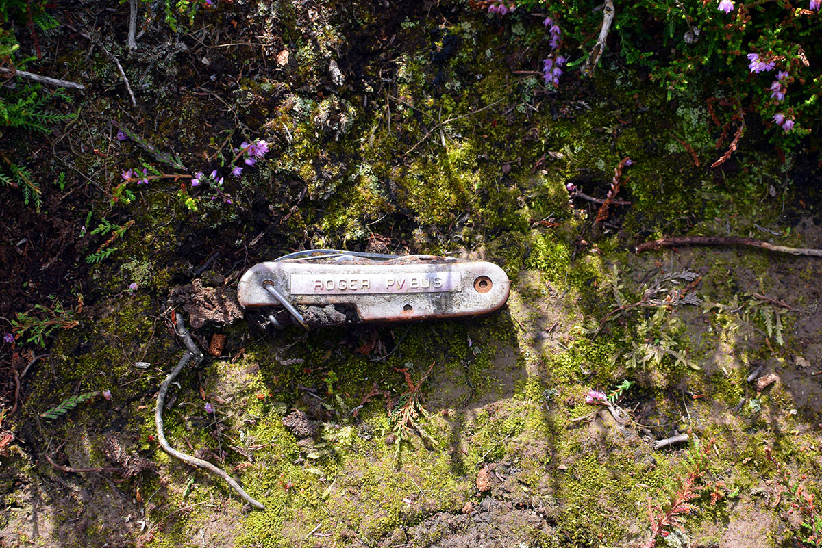
I walked up to the pickup and had a chat with the keeper. He was friendly enough and told me that he was checking to ensure that I wasn’t going to have a barbecue or fly a drone over the moor. He told me about the sculpture that his boss had erected on the far horizon. I told him that I was more interested in standing stones and asked him if Roger Pybus was one of the blokes he worked with, he said he was so I gave him the knife to return to its’ owner.

On the skyline, Seated Man, a sculpture by Sean Henry commissioned by the estate owner David Ross and erected on Castleton Rigg. To the right of the sculpture are a group of visitors.

The keeper, satisfied that I wasn’t a hungry drone pilot, went on his way and I continued eastward across the moor. This side of the moor is dotted with low cairns and banks.
My next destination was the large embanked enclosure on eastern end of the moor. The enclosure is located on fairly level ground just before it dips down into the valley to where the River Esk meets the Baysdale Beck.


The Enclosure is about 40m square with fairly well defined walls. The walls are made of stones with the occasional large upright stone on the inner face. The walls stand at about 1.5m high and 2-3m wide. There is a 3m entrance on the east side. The general consensus is that the structure is Iron Age in date, but this is not certain.
I spent a little time walking around the enclosure and admiring the views along the Esk Valley to Castleton and then headed back to the road and Hob Hole via the Esk Valley Walk footpath.
Regarding the relationship between Hob Hole and the prehistoric remains, Stanhope White makes this observation
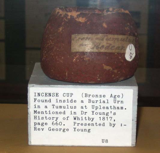
..the belief in a race of little men who lived under the earth may stem from the first interaction of the Celts with the indigenous Bronze Age people. When from time to time, a howe was opened for some purpose, possibly to win stone, if the so-called incense cups were found, they were regarded as proof of the presence of little men.
The North York Moors. An Introduction. Stanhope White. 1979
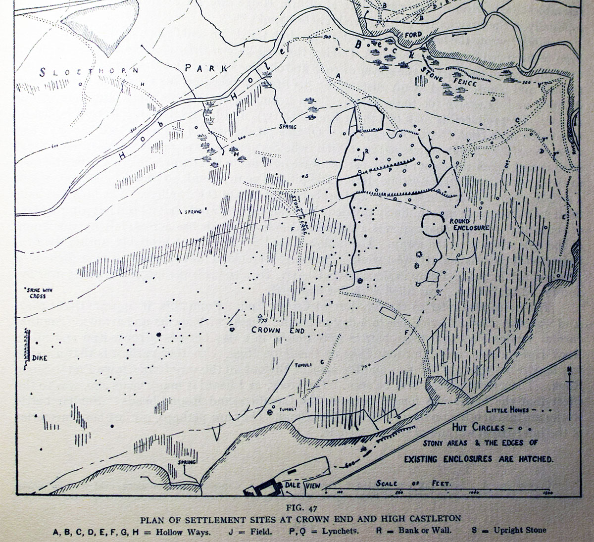
Frank Elgee’s map of Crown End.
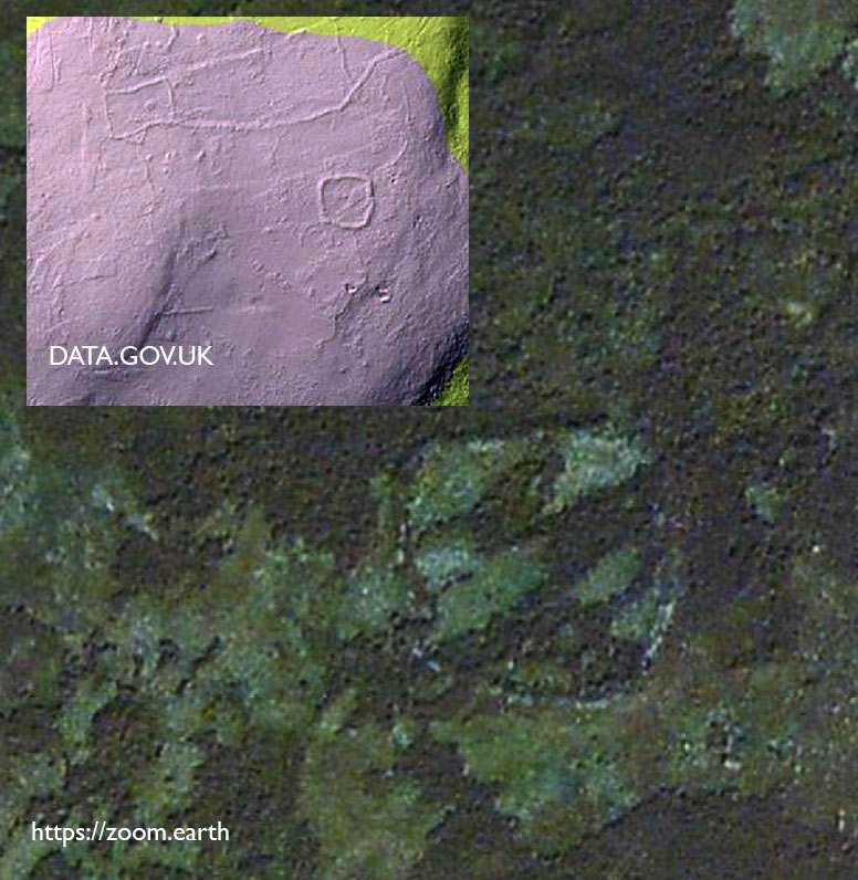
A lidar image and aerial view of the Crown End enclosure
