
Albion


I bought a copy of this publication yesterday, it’s wonderful, I’d highly recommend it.

I bought my copy from the excellent Book Corner in Saltburn. Its available as a printed book or digital format, the printed version is selling out quickly so you may have to hunt down a copy. Further details can be found here.
As a lecturer of photography at degree level, Jamie Macdonald wanted to create a series of films that would inform, educate and inspire others. Where better to start than with a film about his own father, internationally renowned photographer, Ian Macdonald?
Walking from Farndale up towards Rudland Rigg, we followed the track up the side of Monket Bank. The track climbs up through the old jet workings and quarries along the moor edge.
In the 14th century this route was known as Monckgate and linked Bransdale with Farndale. The track was used as a Church or Corpse Road with coffins being carried over the rigg to Cockan Kirk in Bransdale.

The road across the rigg is now known as Westside Road, in the past, it was known as Waingate, running from Kirkbymoorside Market Place in the south to Battersby Bank in the north.

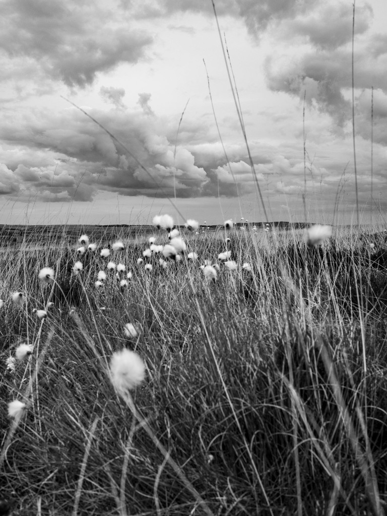
We cut out across the moor towards Ousegill Head and the Three Howes. Flint tools had been found by the gamekeepers for a number of years so in September 1973 Raymond Hayes and others excavated the area. His small excavation yielded over 800 flints from an area of 3.50 x 3.0m. The site was interpreted as ‘A temporary camping site in a forest clearing, probably being occupied by hunters following red deer or other game.’
Whilst at the Three Howes we saw a Red Kite being harassed by an anxious Curlew. Once the Kite had rid itself of its tormentor it flew directly over us, a joyful moment, this was my first sighting of a Kite on the moors.

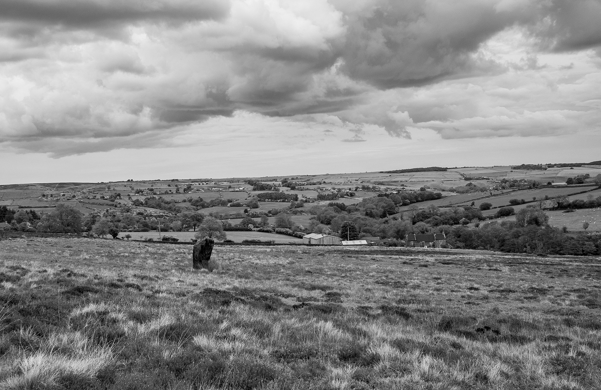
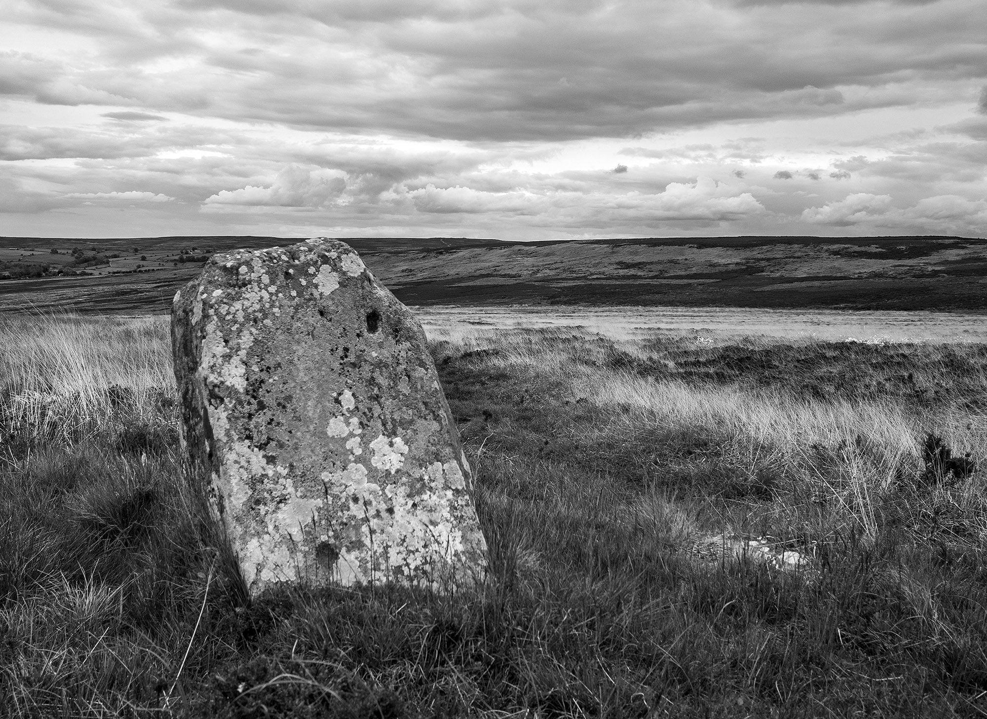
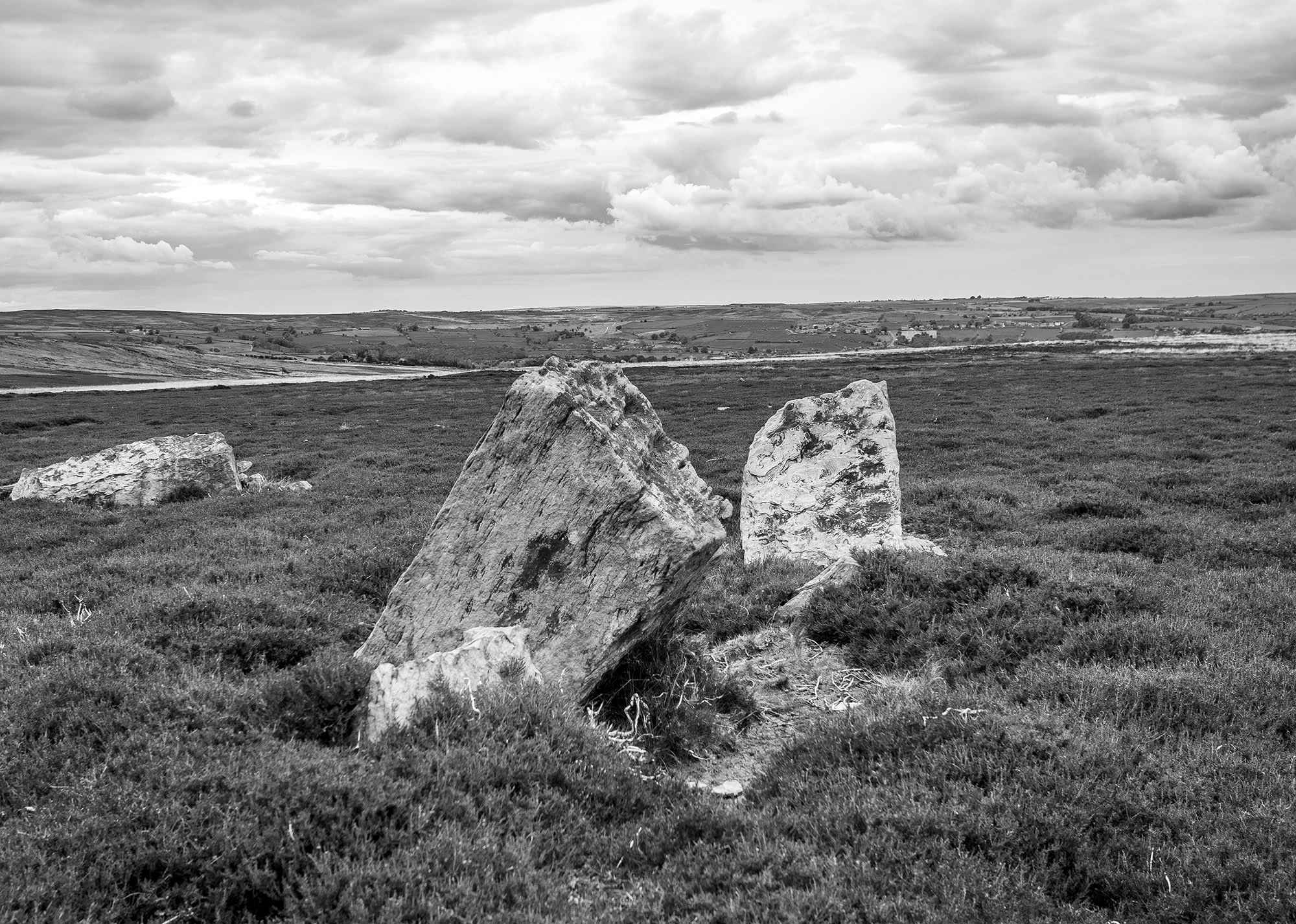
We walked back across the old peat workings and rejoined the track, moving on to the waymarker at Cockam Cross and then onto our final goal, the Cammon Stone.

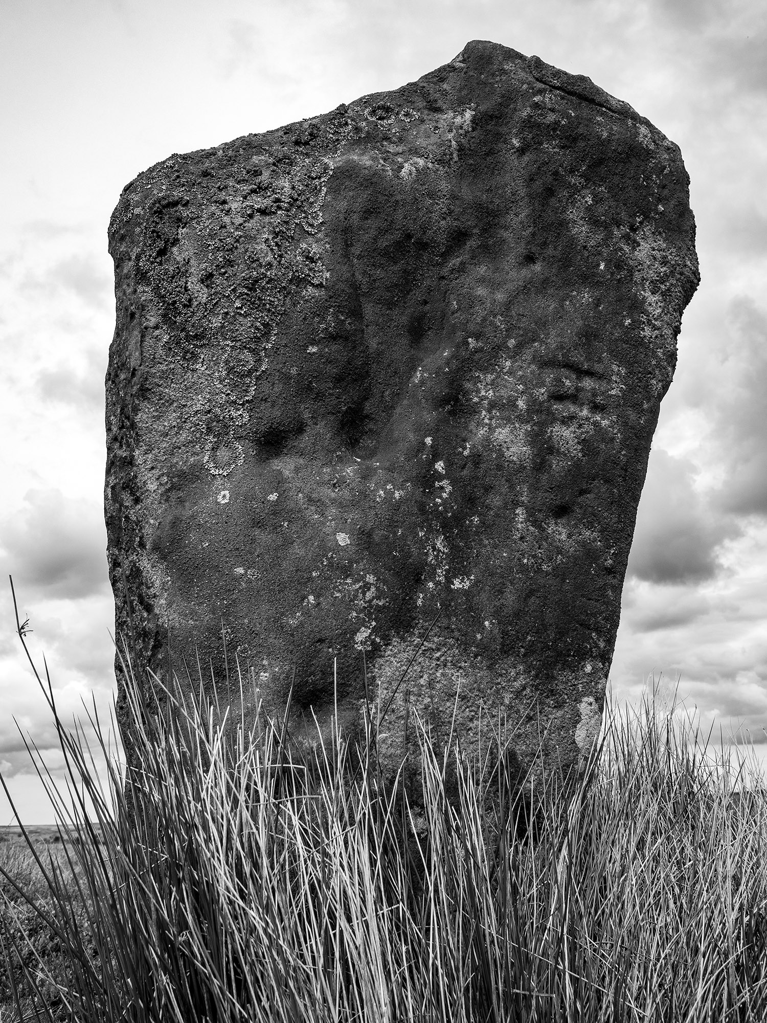
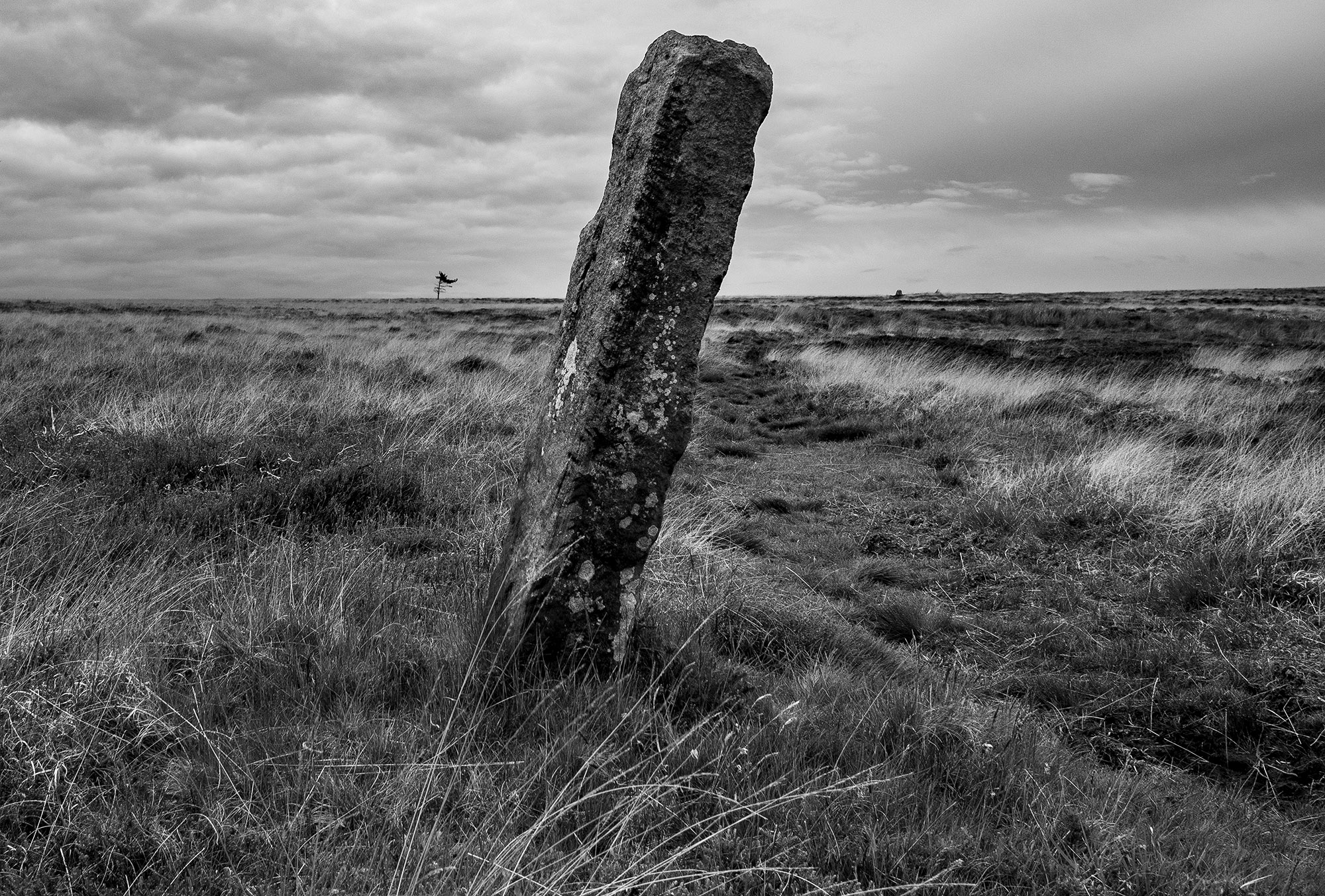
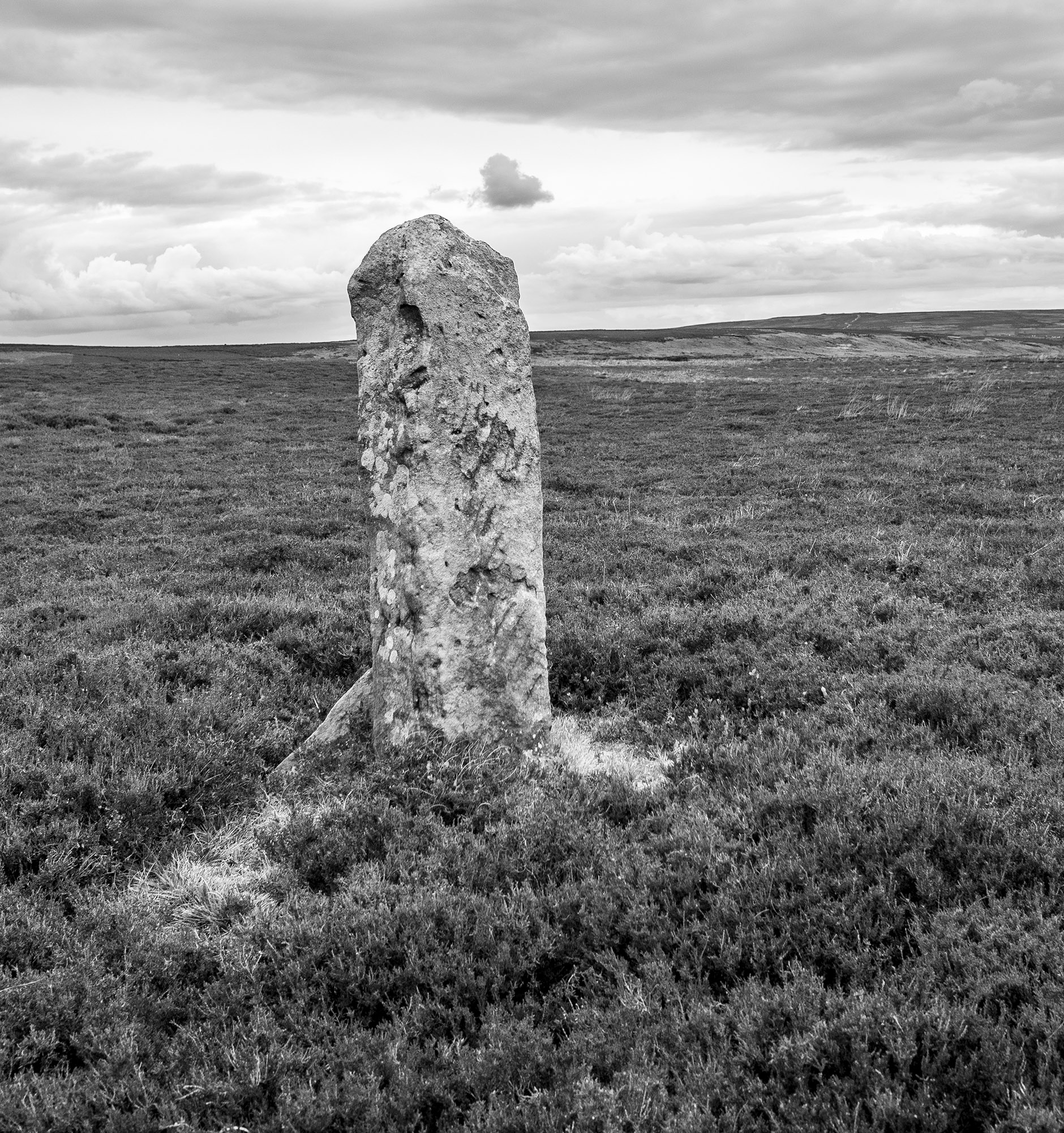
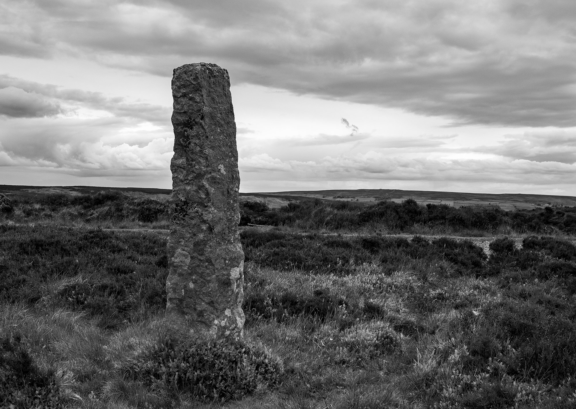
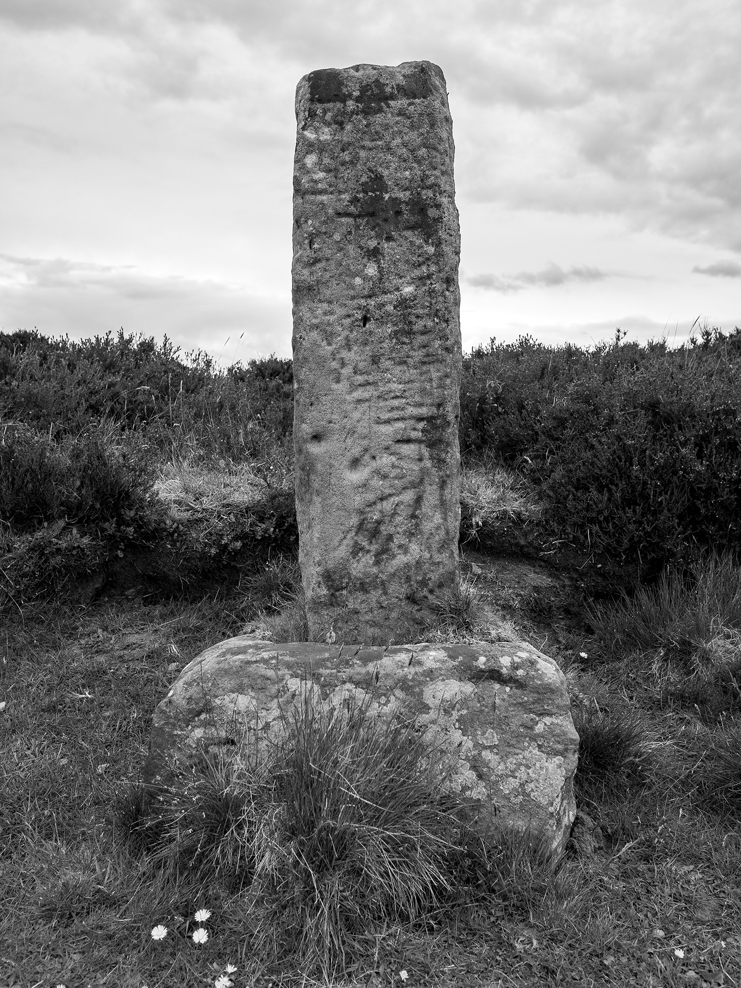
The Cammon Stone is a prehistoric standing stone that sits just beside the main track. The stone is about a metre and a half tall and leans towards the west. I have been visiting this stone on and off for at least two decades, my perception is that the lean of the stone has increased over the years but I may be wrong, I hope I am. The southern views from the stone look down along Bransdale, the axis of the stone is also aligned in this direction, which is probably no coincidence.
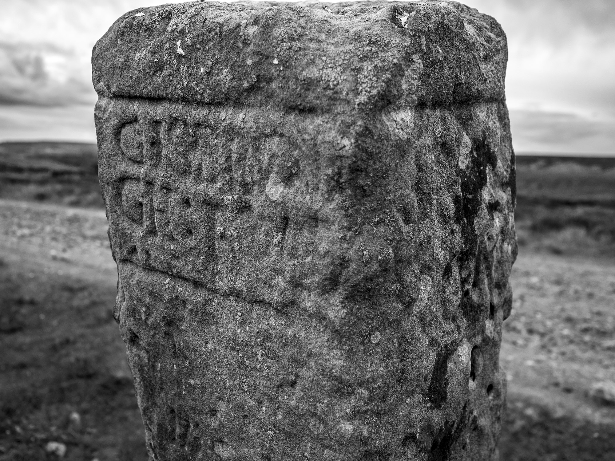
There are a number of faded letters carved onto the western face of the stone, in the past, antiquarians had speculated as to whether these letters were Phoenician in origin. They are actually Hebrew and spell out the word halleluiah. They are thought to be the work of the Reverend W Strickland, Vicar of Ingleby. Strickland is thought to be responsible for carving a number of inscriptions in this area.

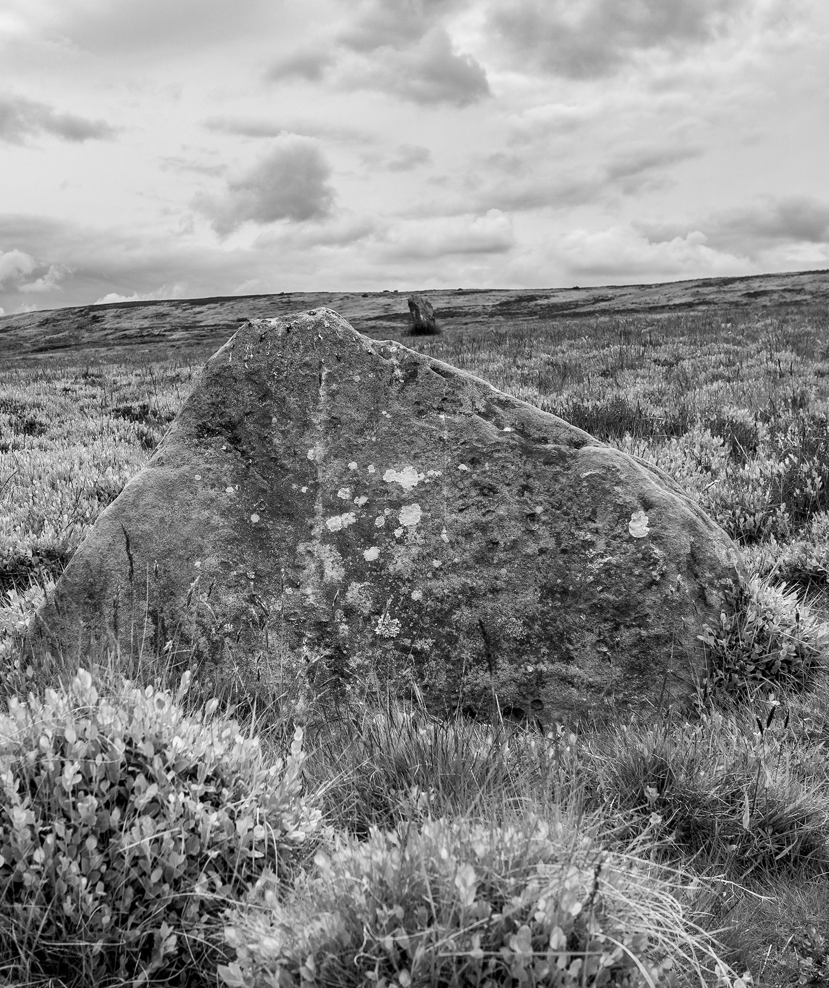
There is a second stone, a large flat slab. No one knows whether this slab ever stood upright. There is no obvious weathering patterns to indicate that it might have been upstanding but I guess that question could only ever be answered by an archaeological investigation.

We picked our way along a track that ran from the moortop into Farndale and joined the daleside road at Spout House. If you are a fan of stone walls and troughs, you will love this road, it has massive walls with stone-lined gutters and numerous multiple carved stone troughs. The stonemasons and wallers were once kept busy in this area.
Also on this road is the Duffin Stone, a massive boulder that has tumbled down from the escarpment side and is embedded into the verge of the narrow lane. The stone bears the scars of contact with many vehicles.
Etymology
Waingate – OE Waen Way – Waggon Road
Monket – The ‘Mun(e)k(e)’ spellings suggest ‘monks’, but in the absence of monastic associations one might suspect an earlier ‘Mened-cet’ (Welsh Mynydd-coed) – ‘forest hill’. Here one might compare ‘Monket House’ in north-east Yorkshire.
Cammon Stone – Cam Maen – Bank Stone.
Rudland – OE hrycg ON hyrggr ‘ridge’.
Sources
Old Roads & Pannierways in North East Yorkshire. R. H. Hayes.1988. The North York Moors National Park.
Yorkshire Archaeological Journal. Vol.67. 1995. The Yorkshire Archaeological Society.
The Consise Oxford Dictionary of English Place-Names. Eilert Ekwall. 1974. Oxford.

Whitby, 1816. In making up the census for 1816 no account was taken of the employment of females, except in a few instances. There were probably about 200 mantua-makers (dressmakers) and milliners, including apprentices. I heard of no less than seven who follow the honourable occupation of sorceress or fortune-teller: and it seems they are so well employed, that another worthy matron has recently commenced business in the same line.
Young. A History of Whitby And Streoneshalh Abbey, etc. By the Rev. George Young. 2 vols. Whitby 1817.
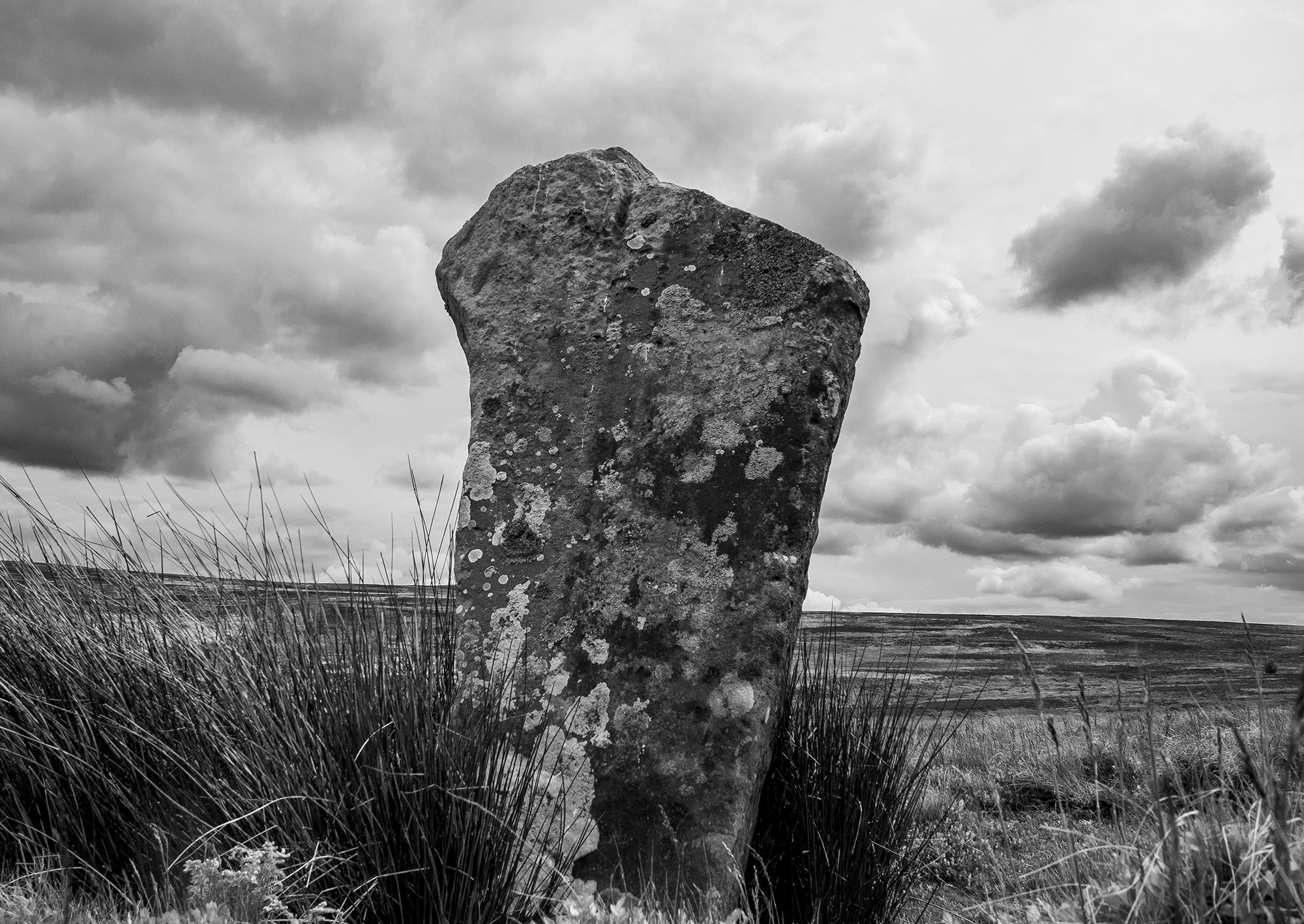
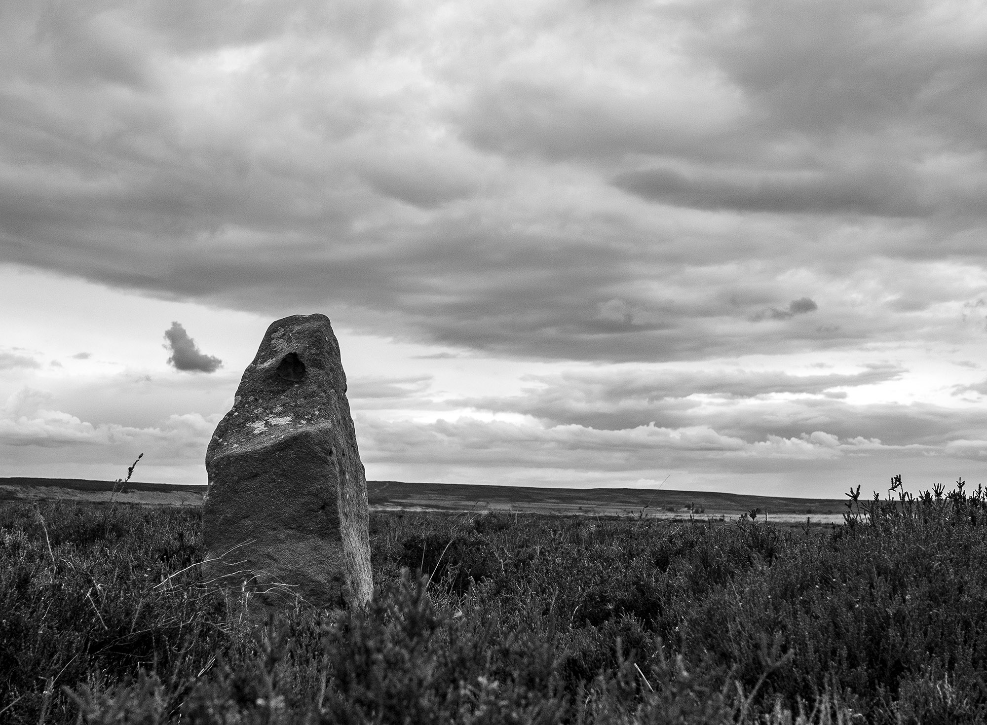
I took a trip over to Glaisdale to visit one on my favourite North York Moors standing stones. This rarely visited, tall, beautiful stone is one of a pair of upright stones located on Glaisdale Swang
Swang – a boggy stretch of land.
When I arrive at the stone I’m confronted by an anxious pheasant hen who starts running in circles around me, a tactic designed to distract me while her brood of chicks scatter for the shelter of the nearby heather.
I can see another stone on the moor edge in the distance, I know that this will probably be a guide stone but probably isn’t good enough, I head for the higher ground. The ground is marshy, so I zig zag my way up the narrowing valley following the lush green carpet of bilberry which tends to grow on the better drained ground. Curlews and lapwings rise in alarm and noisily track my progress as I move from one birds territory to another. Towards the top of the swang, a large hare breaks cover.
As I move onto the high moor guide stones mark the track. Many of these stones date to the 18th century, others may possibly be far older. On October 2nd, 1711, the Justices sitting at Northallerton ordered that guide posts should be erected throughout the North Riding.
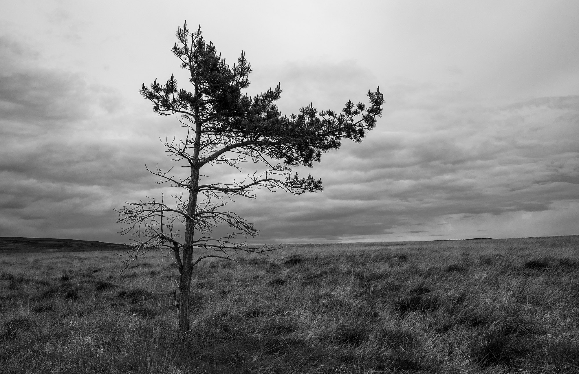
A solitary pine tree on the moor top, its branches indicate the direction of the prevailing winds.
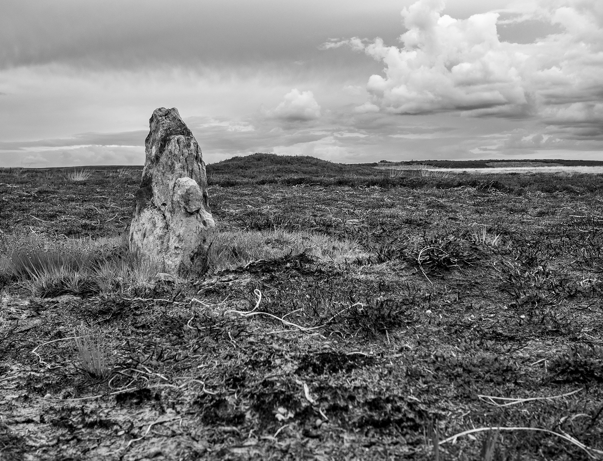
Walking across across the high moor towards Glaisdale I encounter a couple of low standing stones one of which is close to a low mound. These stones are not on the track and are too small to be guide stones. Another group of large stones look as through they were once standing but it is difficult to say much more about them.
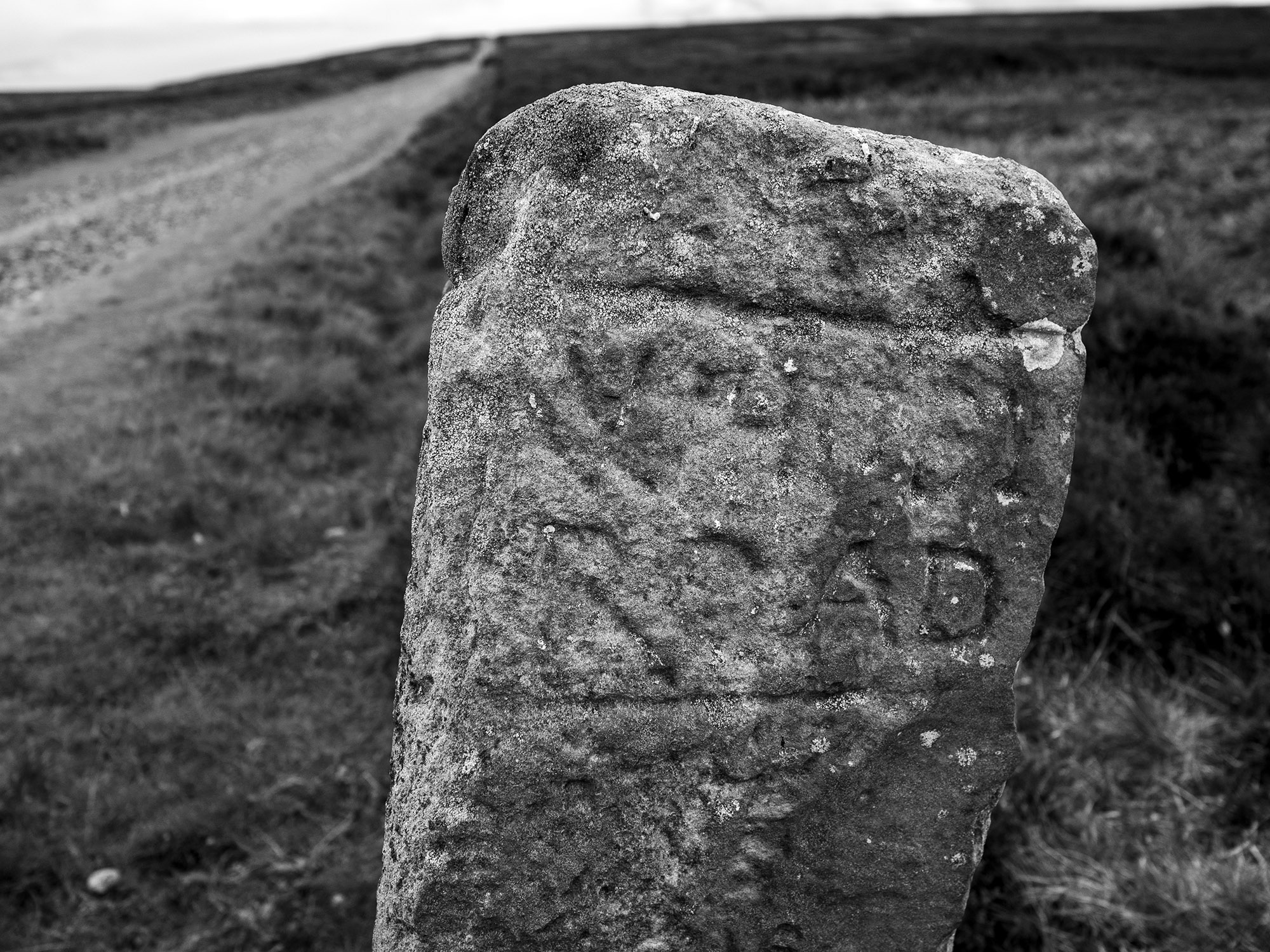
This guide stone was carved and erected by Thomas Harwood about 1735. Harwood erected four other similar stones on Glaisdale Rigg. The stone appears to be housed in an old cross base. It is possible to make out the inscriptions on the north and east faces, they read Gisbrogh Road and Whitby Road. The other two faces are illegible, Stanhope White writes that the south face reads Glaisdale Road TH.
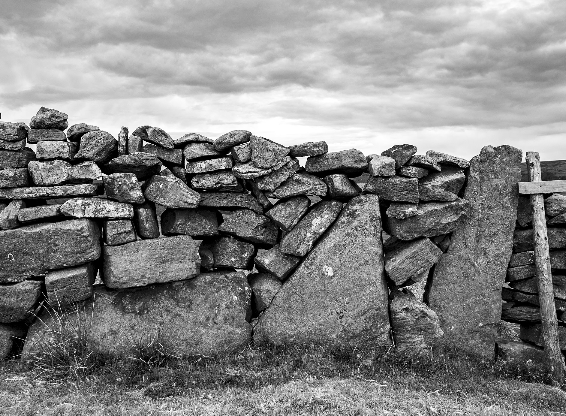
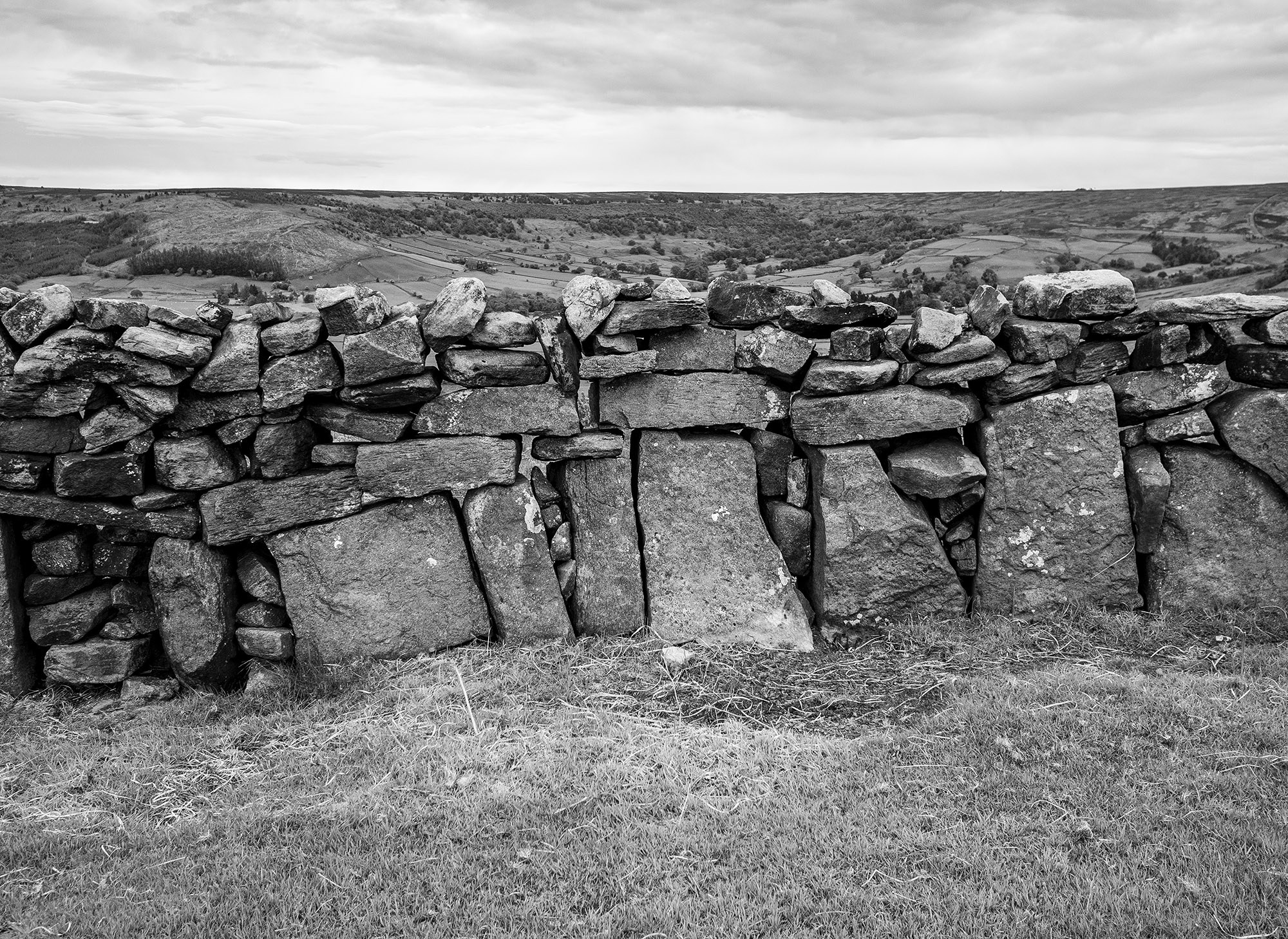
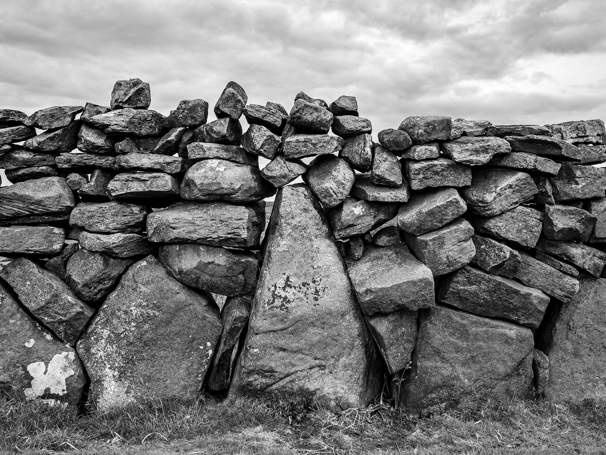
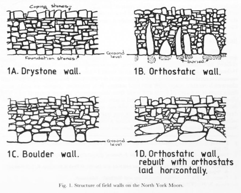
Walking over to the edge of Glaisdale I find this beautiful orthostatic wall, a real joy. About a century ago many of the original field walls across the moor and dales were rebuilt by professional wallers, this wall may be a survivor of an earlier age.
In his book, Some Reminiscences & Folk Lore of Danby Parish & District, Joseph Ford writes of Stone-Rearing Days. These were occasions when a farmers neighbours gathered together to build walls around newly-enclosed fields. Ford thinks that this tradition may stretch as far back in time to the original settlers of the moorland dales.
Etymology
Glaisdale – YN [Glasedale 12 Guisb. Glasedal 1223, Glasdale 1228 FF] ‘The valley of R Glas’
OW gleis, Welsh glais ‘stream’
Glas is a British river-name derived from the Welsh glas ‘blue, green, grey’
Sources
Yorkshire Wit, Character, Folklore & Customs. R Blakeborough. W Rapp & Sons Ltd. 1911
The North York Moors. An Introduction by Stanhope White. The Dalesman Publishing Co. 1979
Some Reminiscences & Folk Lore of Danby Parish & District. Joseph Ford. M.T.D. Rigg Publications. 1990
The Concise Oxford Dictionary of English Placenames. E Ekwall. 1974
Orthostatic Field Walls on the North York Moors. D.A. Spratt. Yorkshire Archaeological Journal No. 60 1988


I found a box of some of my old photos.
I used to take my kids out on stone finding expeditions. My daughter once told me that she would call Childline if I took her to see another stone circle.


