Walking from Farndale up towards Rudland Rigg, we followed the track up the side of Monket Bank. The track climbs up through the old jet workings and quarries along the moor edge.
In the 14th century this route was known as Monckgate and linked Bransdale with Farndale. The track was used as a Church or Corpse Road with coffins being carried over the rigg to Cockan Kirk in Bransdale.

The road across the rigg is now known as Westside Road, in the past, it was known as Waingate, running from Kirkbymoorside Market Place in the south to Battersby Bank in the north.

We cut out across the moor towards Ousegill Head and the Three Howes. Flint tools had been found by the gamekeepers for a number of years so in September 1973 Raymond Hayes and others excavated the area. His small excavation yielded over 800 flints from an area of 3.50 x 3.0m. The site was interpreted as ‘A temporary camping site in a forest clearing, probably being occupied by hunters following red deer or other game.’
Whilst at the Three Howes we saw a Red Kite being harassed by an anxious Curlew. Once the Kite had rid itself of its tormentor it flew directly over us, a joyful moment, this was my first sighting of a Kite on the moors.

We walked back across the old peat workings and rejoined the track, moving on to the waymarker at Cockam Cross and then onto our final goal, the Cammon Stone.

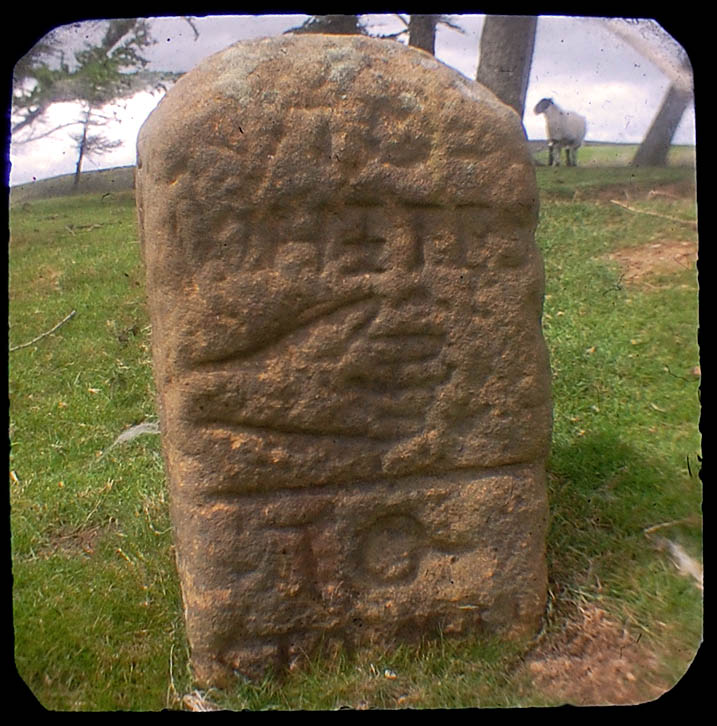
The Cammon Stone is a prehistoric standing stone that sits just beside the main track. The stone is about a metre and a half tall and leans towards the west. I have been visiting this stone on and off for at least two decades, my perception is that the lean of the stone has increased over the years but I may be wrong, I hope I am. The southern views from the stone look down along Bransdale, the axis of the stone is also aligned in this direction, which is probably no coincidence.
There are a number of faded letters carved onto the western face of the stone, in the past, antiquarians had speculated as to whether these letters were Phoenician in origin. They are actually Hebrew and spell out the word halleluiah. They are thought to be the work of the Reverend W Strickland, Vicar of Ingleby. Strickland is thought to be responsible for carving a number of inscriptions in this area.

There is a second stone, a large flat slab. No one knows whether this slab ever stood upright. There is no obvious weathering patterns to indicate that it might have been upstanding but I guess that question could only ever be answered by an archaeological investigation.

We picked our way along a track that ran from the moortop into Farndale and joined the daleside road at Spout House. If you are a fan of stone walls and troughs, you will love this road, it has massive walls with stone-lined gutters and numerous multiple carved stone troughs. The stonemasons and wallers were once kept busy in this area.
Also on this road is the Duffin Stone, a massive boulder that has tumbled down from the escarpment side and is embedded into the verge of the narrow lane. The stone bears the scars of contact with many vehicles.
Etymology
Waingate – OE Waen Way – Waggon Road
Monket – The ‘Mun(e)k(e)’ spellings suggest ‘monks’, but in the absence of monastic associations one might suspect an earlier ‘Mened-cet’ (Welsh Mynydd-coed) – ‘forest hill’. Here one might compare ‘Monket House’ in north-east Yorkshire.
Cammon Stone – Cam Maen – Bank Stone.
Rudland – OE hrycg ON hyrggr ‘ridge’.
Sources
Old Roads & Pannierways in North East Yorkshire. R. H. Hayes.1988. The North York Moors National Park.
Yorkshire Archaeological Journal. Vol.67. 1995. The Yorkshire Archaeological Society.
The Consise Oxford Dictionary of English Place-Names. Eilert Ekwall. 1974. Oxford.

