Dykes on the Tabular Hills

The linear dykes of the Tabular Hills of north east Yorkshire are the third largest group in Britain both in area and the number of dykes.

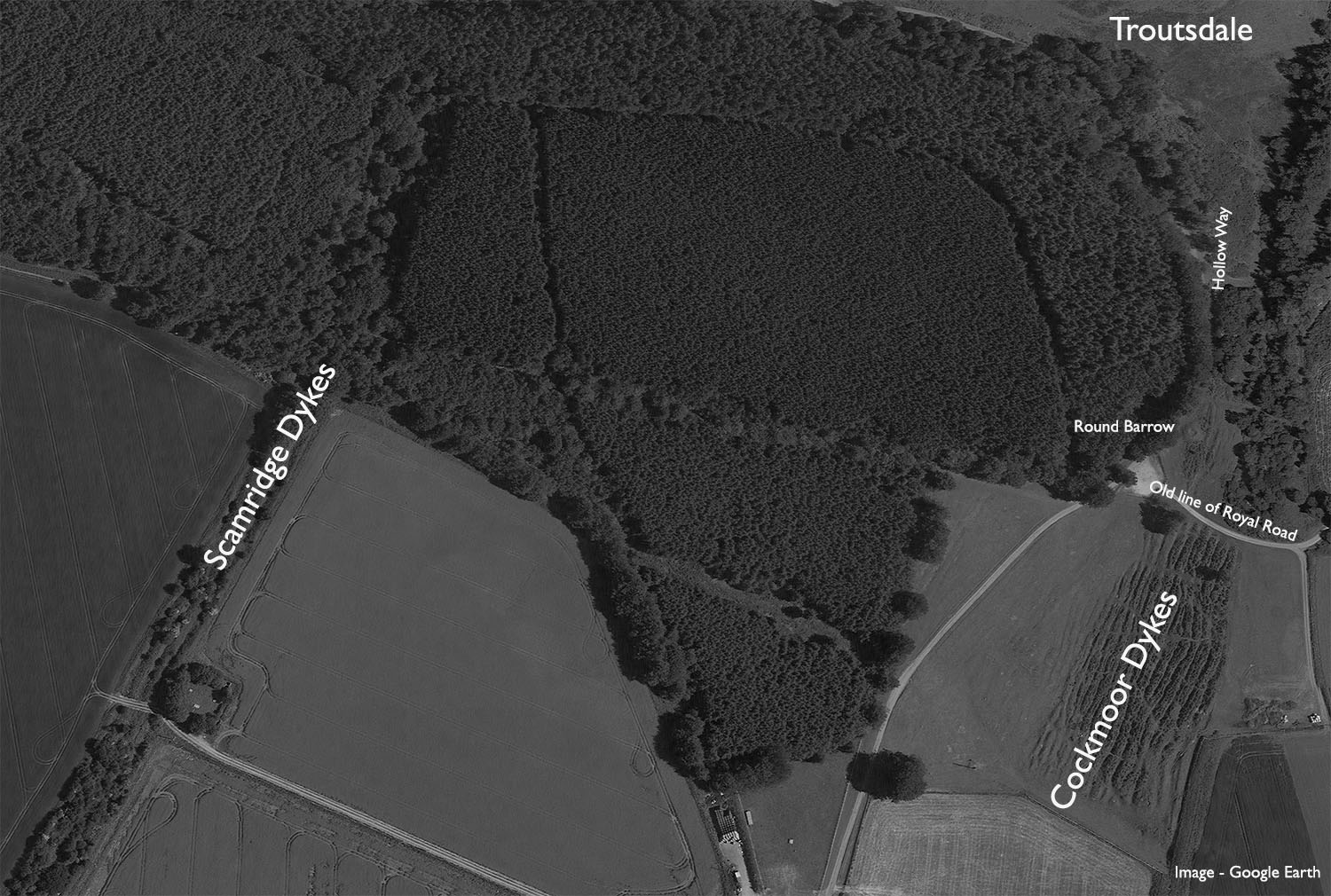
The Scamridge Dykes are the most famous of the North Yorkshire Dykes, they run six abreast in a large curve for almost three kilometers from the scarp edge of Troutsdale south to the head of Kirkdale.  Their scale can only really be appreciated from the air. The dykes are thought to be prehistoric in origin, they most probably define prehistoric territorial boundariesDykes

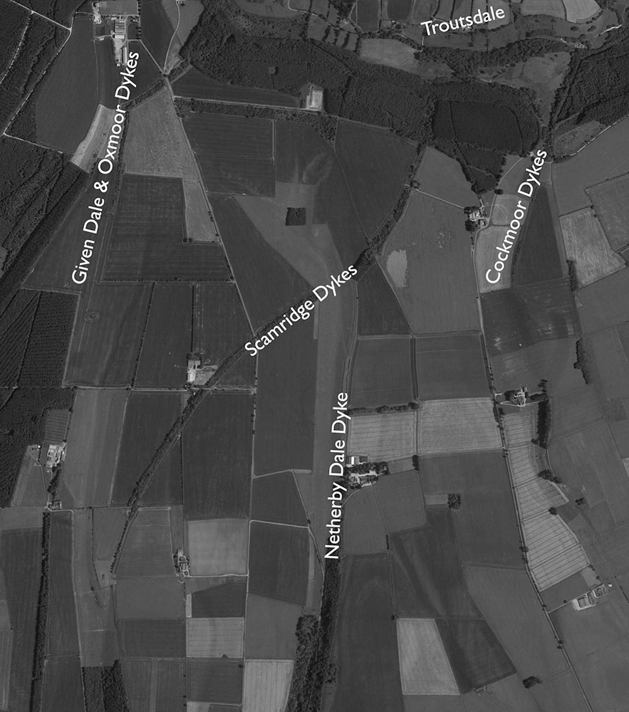
The Cockmoor Dykes also run south from the Troutsdale scarp where as six large dykes. As they run south to Wydale they are joined by another fourteen smaller parallel dykes.  The six large dykes are thought to be prehistoric and the additional dykes are thought to be burrowing mounds connected with the large-scale rabbit warrening industry of the eighteenth and nineteenth centuries.

Cockmoor

My friend Chris Corner and I took a trip down to the Tabular Hills to have a look at these mighty earthworks. We started by trying to find an embanked pit alignment at Givendale but found nothing apart from dense conifer woodland, debris and deep forestry plough ruts. We moved east to Cockmoor.

OLYMPUS DIGITAL CAMERA

The multiple small dykes at Cockmoor, probably the result of commercial rabbit warrening.

OLYMPUS DIGITAL CAMERA

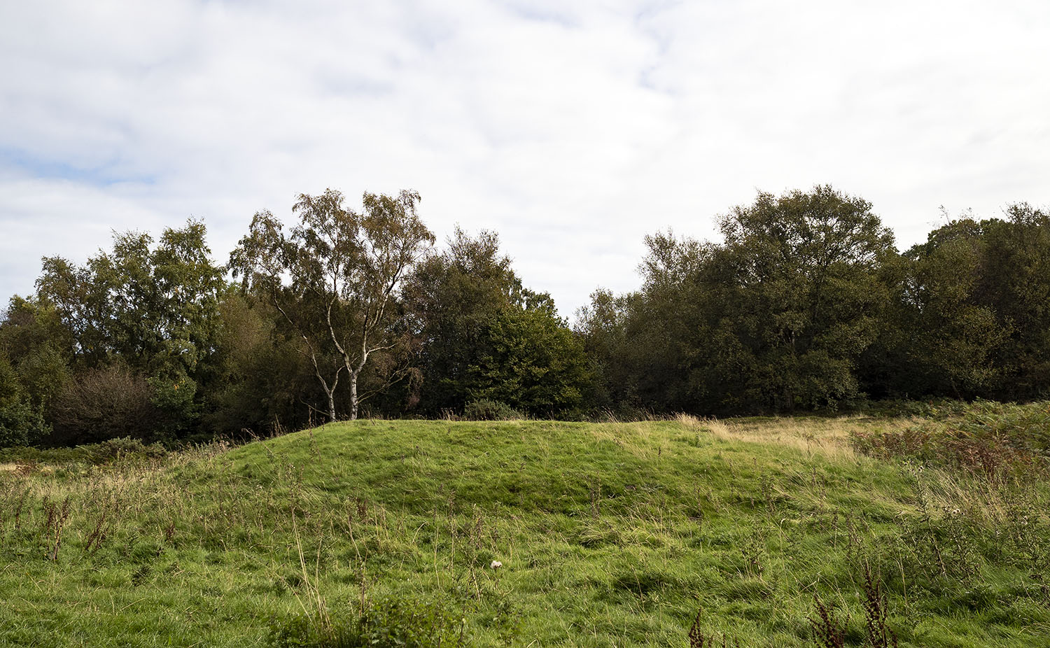
One of three round barrows on the margins of the Cockmoor Dykes. The other two barrows have been destroyed by agricultural activities.

OLYMPUS DIGITAL CAMERA

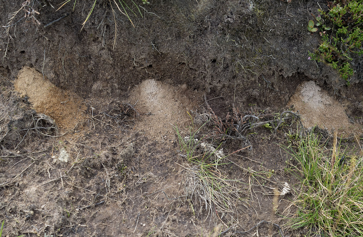
The rabbits have all gone. Tiny spoil heaps in the sides of the dyke, probably caused by burrowing miner bees.

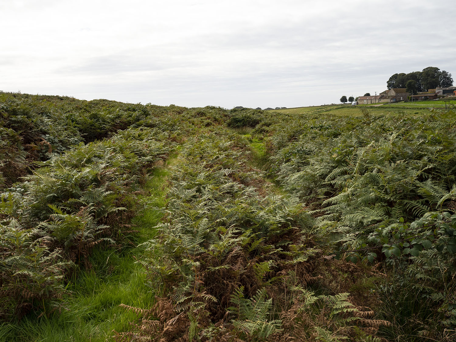
One of the six large Cockmoor Dykes running down to the scarp edge overlooking Troutsdale.

A Penny Bun & Oysters

The Scamridge Dykes form a dense mixed woodland corridor across the large open fields.

 We dropped down into Troutsdale and come across this beautiful abandoned building. Chris informs me that it is a school house built in 1870

Map

Sources

Linear Earthworks of the Tabular Hills, North East Yorkshire. D.A Spratt 1989

MAGIC

Historic England

Google Earth


A Stone Circle, Hob’s Heap & the Coal Mines of Harland Moor Pt 1.

Yesterday I realised that I’d recently written a blog post about manhole covers..manhole covers! I’ve had a fairly odd few weeks which have left me unable to venture to far from home, I needed to clear my head and for me the best way to do that is a mooch across an empty moor. I sent my good friend and co-conspirator Chris Whitehead a message, an hour and a half later we met in the car park of the Lion Inn on Blakey Ridge, our destination Harland Moor.

It’s a lovely drive down to Harland Moor we stopped briefly on Blakey Rigg to admire the beautifully carved handstone.

hand-stone

After dodging suicidal pheasants we arrived at the circle which is marked on the OS map as a cairn. The circle was discovered by W R Crosland in 1930 and was described as an embanked circle 70ft in diameter with upright stones set at intervals.  

It had been at least a decade since I last visited the circle and remembered it as a rather ruinous place. I was surprised to find it quite recognisable, a slightly raised bank set with stones. The circle is bisected by a hollow way with dense heather and bracken in the northern and eastern quadrant, which made spotting the stones a little difficult.

harland-circle

harland-circle1

Britain’s foremost expert on stone circles, Aubrey Burl, gives the circle a classification of 3 (Ruined but recognisable), I wouldn’t argue with that. A few metres to the west of the circle there are a number of stones that may be the remains of prehistoric walling but are so ruined that it is hard to tell. Interestingly, the three stones in the picture below are aligned 130 – 300 degrees which roughly aligns to the winter solstice sunrise and summer solstice sunset for 2000BCE.

harland-circle2

The main viewshed from the circle is to the south and west across the green tabular hills dipping down to the fertile Vale of Pickering below. The views to the north and east are of the golden brown high moors intercut with fertile green dales.

We decided to leave the circle, fortified by ripe, fat, sweet, juicy bilberries we headed north across the moor.

Sources

A History of Helmsley & Rievaulx & District. J. McDonnell 1963

Prehistoric & Roman Archaeology of North East Yorkshire. D A Spratt 1993

The Stone Circles of Britain Ireland and Brittany (Revised Edition). A Burl 2000