The Black Path is a track that follows, for much of its route, the Middlesbrough to Redcar railway line. The final sections run across Warrenby Marsh and then along the South Gare to the river mouth. It also makes up the final stretch of the Teesdale Way, a long distance footpath that follows the River Tees from its source on Cross Fell to the sea. Although it is now seen as a leisure path it has a legacy that may predate the formation of England itself.
The modern path starts just behind the Navigation Pub in Middlesbrough and runs to the mouth of the River Tees. The original path started at the ancient river crossing at Newport and followed the southern bank of the Tees to the river mouth at Tod Point. It is a route that has tracked a boundary between a number of ancient territories, the earliest of which may have been that of the Celtic Briton kingdom of Gododdin or Hen Ogledd, a name which means ‘the old north’.
In the late 5th century it followed the boundary between of the Anglian Kingdom of Deira to the south and the rival Kingdom of Bernicia to the north. These two territories were later combined to form the Kingdom of Northumbria.

Later, the Vikings founded the Kingdom of York, which stretched from the Humber to the Tees, so the paths route once again followed a significant north eastern boundary. The final ruler of the Kingdom of York was the wonderfully named Eric Bloodaxe, a Viking who could claim to have been the last true king of the North. The Kingdom of York gradually became the county of Yorkshire and the path marked the final land section of the counties north-eastern corner.
Following the Norman Conquest in 1066, the north resisted the rule of the conqueror, prompting the new king and his Norman army to ride north to suppress the rebellion. Tradition has it that the English rebels had a camp of refuge on Coatham Marshes. If this is true, the path may well have been the route that the rebels used to escape from the Conqueror when he and his army rode into the district in an unsuccessful attempt to wipe out the rebels. This northern rebellion against king William would eventually lead to the Normans laying waste to much of the North during the infamous ‘Harrying of the North’.

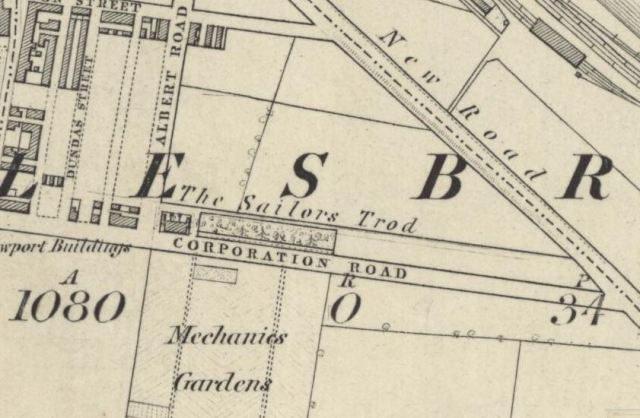
From the Medieval period onwards the path was used by sailors and merchants to travel to and from ships at the ports of Coatham, Dabholm, Cargo Fleet and Newport, the path then became known as The Sailors Trod. This name appears in the early histories and on maps of the new town of Middlesbrough.
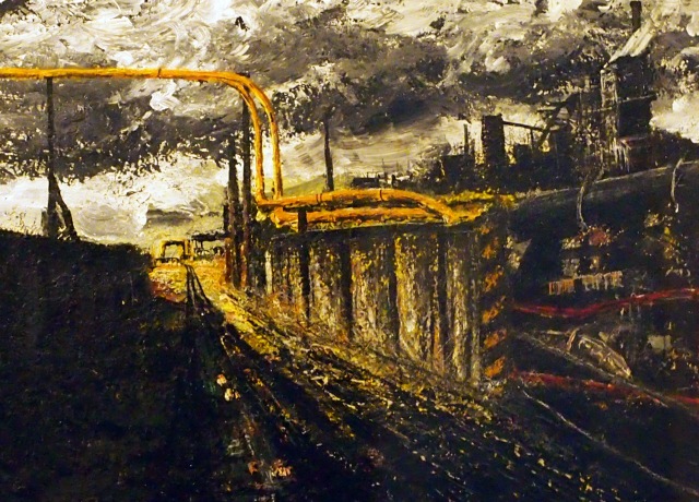
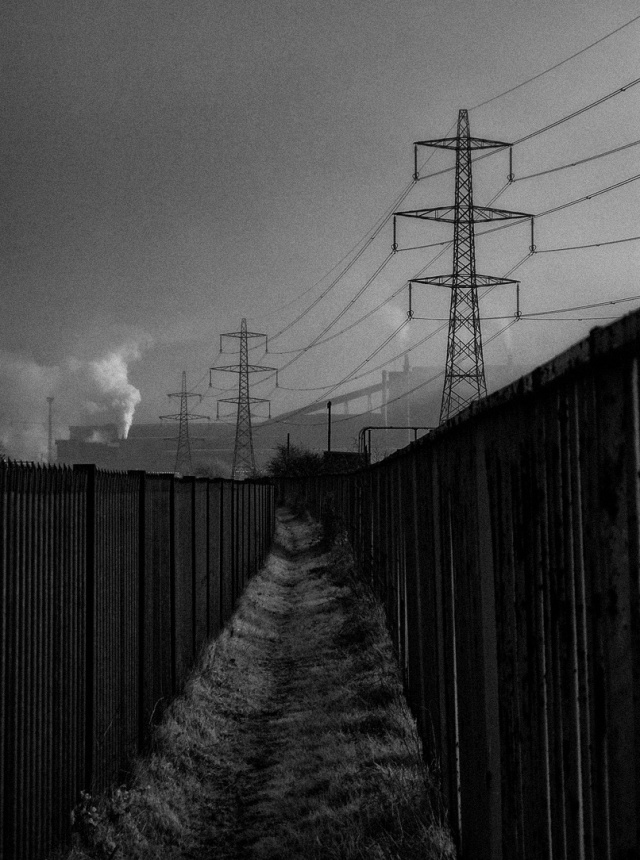
During the industrial age, the railway was laid along the route of the track and the path was used by workers as a convenient route to the many industrial sites that had grown up along the river bank. This is when it became known as the Black Path, named for the industrial grime that lined the route.
As well of being used to move goods between the works along the river, the railway was utilised, along with boats and barges, to transport the materials being used to reclaim the land along the river bank, the reclamation of the land, coupled retaining walls being built along the river, resulted in the river bank moving further away from the route of the path.
I have walked the path many times and have recently noted the re-wilding of the area, I have seen foxes and hares along the path. The slag surrounding the path has decomposed to form lime-rich soils which support a variety plants that you cannot find anywhere else in our area, their seeds were carried through the narrow corridor by trains arriving with cargoes of limestone which was used as a flux in iron production.
Today the path is only used for leisure purposes. I believe that, as it winds its way through the industrial hinterlands of Teesside, it is probably one of the most interesting and dramatic public footpaths in the country. If you have never walked the path I suggest you give it a go, it provides a wonderful insight into our industrial heritage and takes you to places that you cannot reach by any other means.
Paintings –
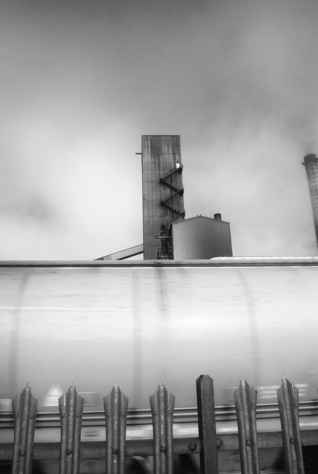
The Black Path by Bob Mitchell. 2016
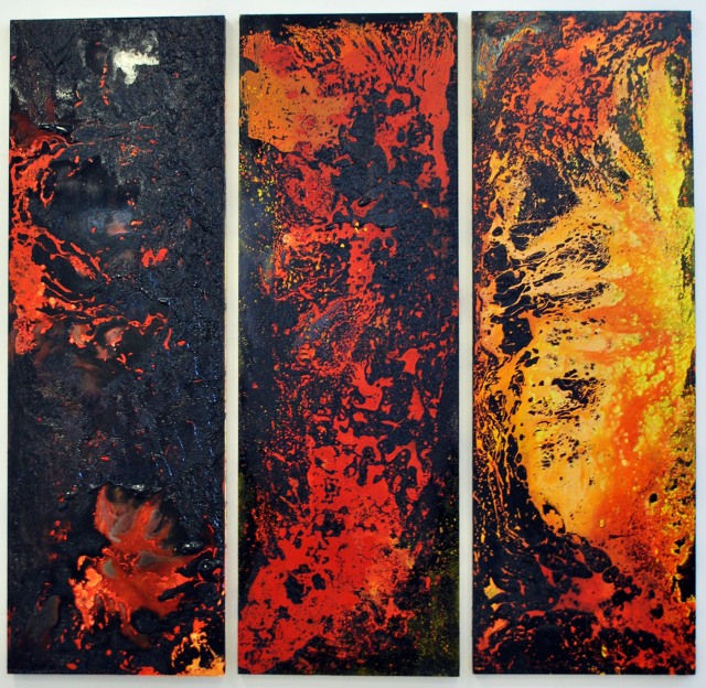
Coke Oven Triptych by Kirsty O’Brien. Painted as the Clay Lane Coke Ovens were closing in 2016
Maps
Northumbria Map Attribution – A compiled visualization from various public sources, CC BY-SA 3.0, link
England Map Attribution – link
Other Maps – Reproduced with the permission of the National Library of Scotland

There’s a compilation sketches on my WordPress blog titled the “Black Path”. One day Iwill holiday on Teesside and walk it again, or ride it anyway. Lovely post Ironopolis. All the best, John
cheers John
I did a bit of research into the Sailors Trod when I worked in a public rights of way department.
Trying to trace the many journeys of the path and the supposed link to the message tree in Albert Park.
https://www.flickr.com/photos/sandjphotography/16396127208/in/photolist-qYSroq-rgjgLA
More details on an old Flickr site of mine here — I think you have commented on it too!
Thank you so much for a very interesting article, there used to be a small snack bar somewhere there near Cargo Fleet, sold hot sandwiches etc.
It was called the ‘Black Path’ because it was continually resurfaced with crushed cinders and slag from the steelworks to prevent it becoming little more than a muddy track.
If there ever was a Black Path it would have originally been to the south of where the rail line is now probably where the road goes through dormanstown the old west coatham lane
leading to the old road from there to stockton or yarm
If there ever really was a black path. It’s still there mate and you wont find it south of the railtrack.
I remember walking that path with my brothers and sister during the depression we pushed a wheelchair with a bell tent on top from westward street to Barker’s Field at Warrenby for a camping holiday mam and dad went by train unfortunately it didn’t end well I finished up in Chatham Hospital for a few weeks after getting caught in a fire in the tent next to us
As a kids (im 65 now)we used to pedal to the breakwater via it , the hardest part was the back of the blast gas holder always about a foot deep in coke dust ! Then on and down the subway at gtown , there was a covered part a works building above us , then the beck that ran along side the path , we then came out onto the trunk road and peddled through (past the council tip) over the River Stell
Concrete bridge , coming at at the level crossing , the gadgie who operated the barriers lived if i remember in either Elm or Oak street south bank
, then onto the gare happy days
Was it not Erik Bloodaxe, and not Eric.
Hi Kathleen, his coinage spells it with a ‘c’ so that was the name he used in York. The old Norse has it as Eiríkr so I guess both are correct.
That concrete bridge over the stell is still there and you can walk over it. It is the only part of that path from the trunk road to fishermans crossing that is still recognisable.