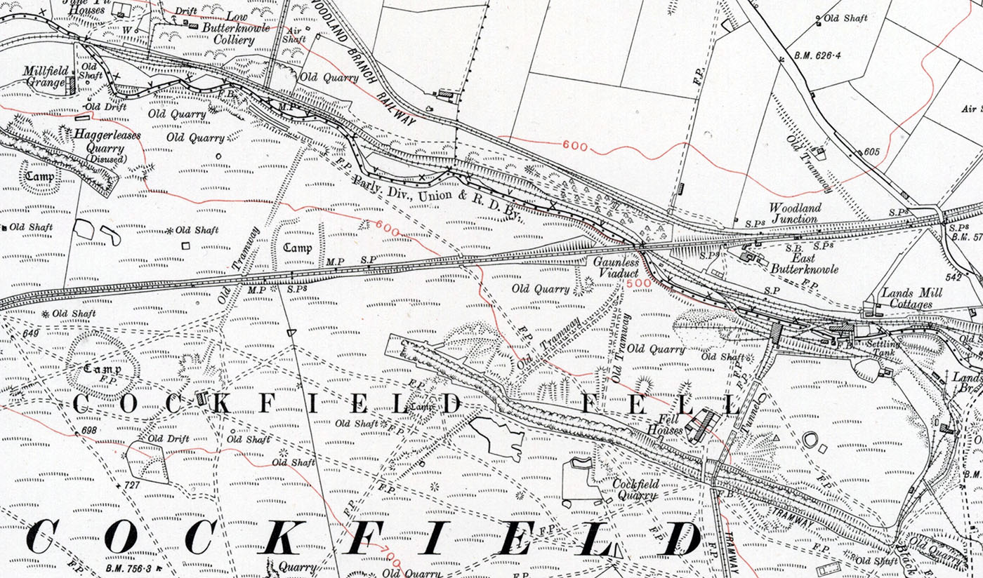
Cockfield Fell is described as “one of the most important early industrial landscapes in Britain”. In addition to four Iron Age (or Romano-British) settlement enclosures, there is evidence within the landscape of early coal mines (the Bishop of Durham licensed mining here at least as early as 1303), medieval agricultural field patterns, centuries of quarrying activity, a railway line established in the 1830s and several earlier tramways All together, Cockfield Fell constitutes England’s largest Scheduled Ancient Monument, described as ‘an incomparable association of field monuments relating to the Iron settlement history and industrial evolution of a northern English County’. One reason for its preservation – unusual for a lowland fell – is that it was not subject to enclosure in the 18th or 19th centuries, perhaps due to its highly industrialised past. Source

The fell is ablaze with fragrant golden whin


The Cleveland Dyke outcrops on the fell and was quarried for roadstone.


The remains of the Gaunless Viaduct
Gaunless ME gaghenles ‘useless’ (from ON gagnlauss). The name may refer to scarcity of fish or the like. English Place-Names. Eilert Ekwall. 1959

Coal was mined on the fell from the early medieval period until the late nineteenth century


Beehive coke ovens on the valley floor

A beautiful Cob keeps me company
Map reproduced with the permission of the National Library of Scotland
Many thanks to Graham Vasey for showing me around this wonderful place
